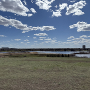
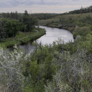
View of Madge Lake on a hazy day, with green reeds in the foreground and forested shoreline.

Madge Moments Part 2: Trails Worth the Bug Spray

ELLA-VATED TRAILS

Tracing prairie trails through memory, discovery, and home.

By Ella Gidluck, SaskTrails Storyteller

Madge Moments Part 2: Trails Worth the Bug Spray

In Part 1 of this Madge Moments series, we met April and Jordan from Duck Mountain Lodge and explored why this place has such a strong pull for locals and travellers alike. But let’s be honest, the trails are what keep people coming back season after season. Whether you’re chasing butterflies, biking with your family, or just trying to dodge mosquitos and your emails, the forest paths around Madge Lake have something for everyone.

Fen Trail

The Fen Trail is a little out of the way, tucked near the ski hill on the edge of the park. It’s a bit of a drive to get there, but I wasn’t complaining. Call me Miss Daisy. I was in full passenger princess mode while my mom chauffeured me down winding roads with no cell service and vibes only.

By the time we reached the trailhead, the signal had vanished entirely, which made the journey feel like a portal into a different world. No texts, no emails, no directions. Just moss, trees, and the distant sound of birds plotting.

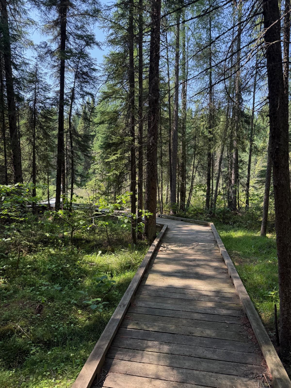
This trail is gentle, with a stunning raised boardwalk through the wetland. It’s cool and quiet, with ferns and filtered light that make it feel like you’ve stepped into a moss-covered secret.

Wooden boardwalk winding through mossy forest on the Fen Trail.

Ferns, fairylike lighting, and the boardwalk of dreams.

My mom, MVP of the day, carried the bag with all the essentials. Water, bug spray, sunscreen, bear spray, snacks, sweaters, and for reasons I will never question, a sudoku book. Because nothing says “prepared hiker” like the option to sit on a bench mid-trail and do a logic puzzle in the shade.

Ella-vated Trail Rating: 5/5 moss patches. Magical with minimal effort.

Madge TCT

This segment of the Trans Canada Trail starts near the tennis courts at Ministik Beach and winds its way into the Pickerel Point Campground. The beginning is bright and open, with trees that make just enough shade to keep things cool. As the trail continues, it passes cabins and starts to feel more enclosed, with thicker forest and a narrower path that pulls you deeper into the trees.

Ella walks down a gravel trail at the edge of Ministik Beach, with tennis courts visible in the background and tall trees lining the path.

Starting the TCT loop like a local, tennis courts to trees in under five minutes.

I didn’t see many people, just the occasional squirrel and birdsong. If you’re looking for a trail that offers a bit more distance without feeling overwhelming, this one’s a good pick.

If you’re into geocaching, this stretch is even more fun. One of the STA board members recently replaced a hidden container near the bridge along this trail (GC4F0Y7 for the real ones). Nature walk meets treasure hunt? Sign me up.

Trans Canada Trail signpost with arrows pointing left and right through the woods.

Choose your own forest adventure. Left or right, it’s all trees.

Ella-vated Trail Rating: 4/5 quiet forest vibes. Best enjoyed without a destination.

Damselfly Trail

I cannot confirm whether I saw an actual damselfly on the Damselfly Trail. What I can confirm is that a mysterious bug landed on a stick I was holding. Did I freak out before we could identify it? Yes, and my mom caught it on camera.

Trailhead sign for the Damselfly Nature Trail with park map and info about biodiversity.

Welcome to the Damselfly Trail: bugs, beauty, and bear warnings included.

This trail is a nice middle ground: not too long, not too short, with enough changes in scenery to keep it interesting. It’s the kind of hike where you start pointing things out to no one in particular, just to keep the conversation going.

Ella-vated Trail Rating: 3.5/5 mysterious bugs. Great scenery, minor emotional damage.

Batka Lake Lookout

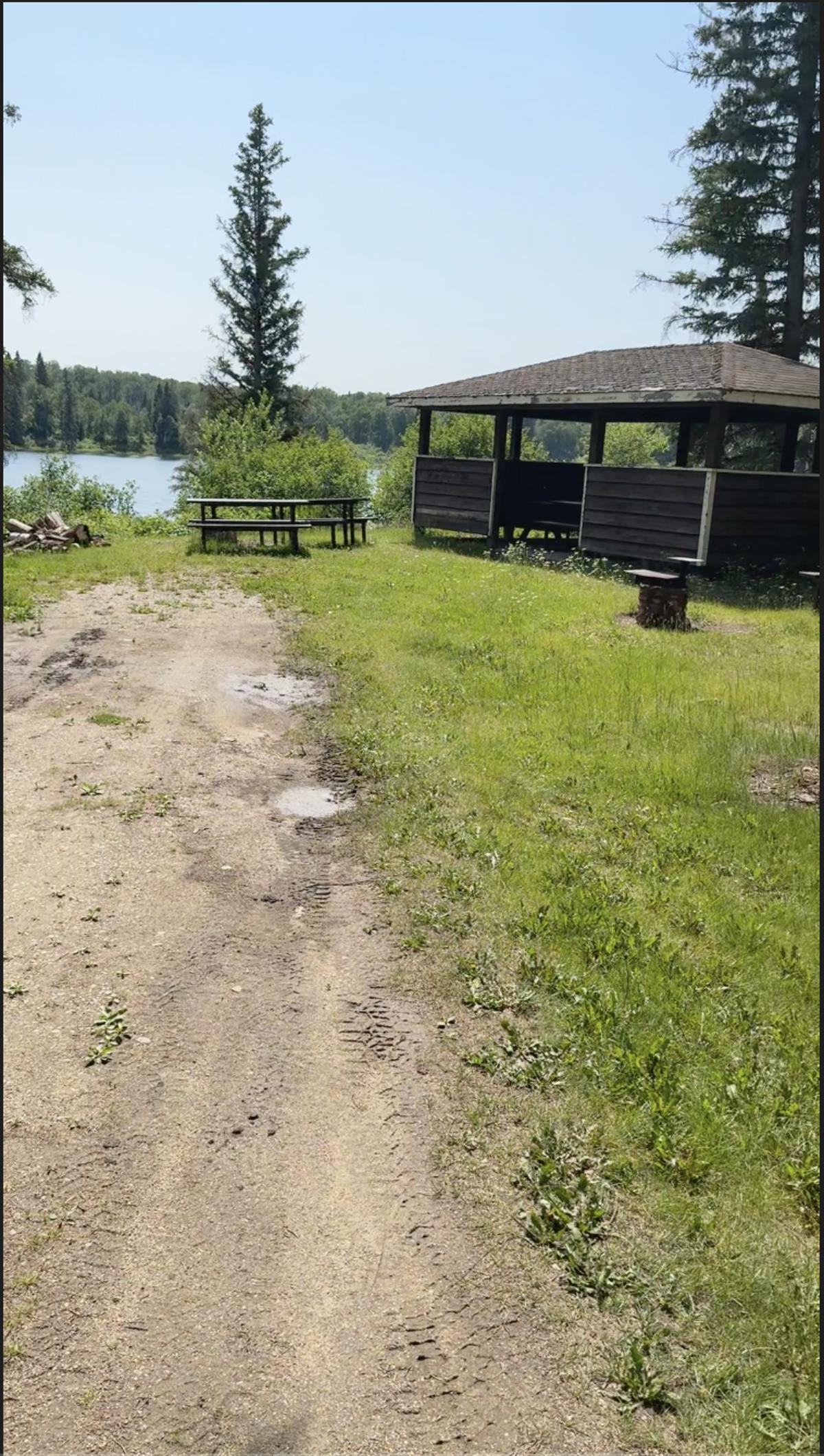
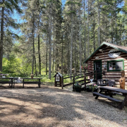
Batka Lake Lookout is not a fancy lookout. It’s a dirt pull-off with a couple of picnic tables, a woodpile, and a view of the lake if you walk around a bit and stand in the right spot. There’s no sign announcing you’ve arrived, just a “No Motor Vehicles” gate and enough shade to make you stay longer than you planned.

I wandered around while my mom scouted ahead and casually carried every possible hiking essential on her back like it was no big deal. It’s the kind of place that doesn’t feel like much, until you realize how peaceful it is. No crowds, little to no cell service, just trees, birds, and the occasional frog judging your footwear.

Picnic table and shelter at Batka Lake Lookout with lake in the background and a quiet dirt path in front.

Not a fancy lookout, just a picnic table and peace.

If you want to keep going, the trail to Moose Lake starts nearby, and there’s a geocache tucked somewhere along it (GC9X4QX) if you’re the type who enjoys finding things hidden in the woods by strangers on the internet.

Ella-vated Trail Rating: 4/5 picnic tables. Not much going on, in the best way.

Trail Sampler: Quick Picks You Might Like

There are a few more trails that deserve a mention, even if we didn’t do a deep dive this time:

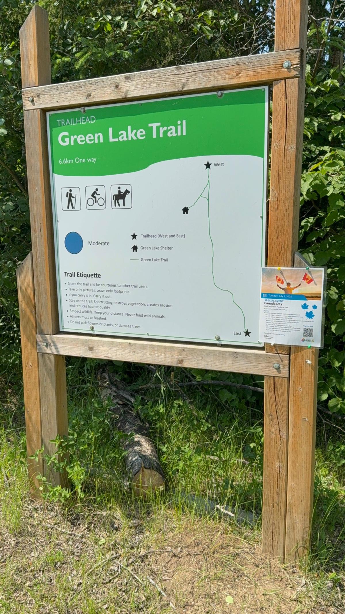
  • Green Lake Trail – An easy loop through the trees. In the winter, the warm-up shelter is a cozy place to stop while snowmobiling. It smells like woodsmoke and good memories.
Trailhead sign for Green Lake Trail showing map, distance, and trail uses.

Green Lake Trail, where snowmobilers and hikers alike find their forest fix.

  • Pelly Point Nature Trail – My family loves to bike this one. It’s gentle, open, and is a good opportunity to get the heart rate up (depending how seriously you take it).
Ella walks along a narrow wooded path surrounded by thick green trees on both sides, heading deeper into the Pelly Point Trail.

Green tunnel vibes: Pelly Point Trail bringing the forest immersion.

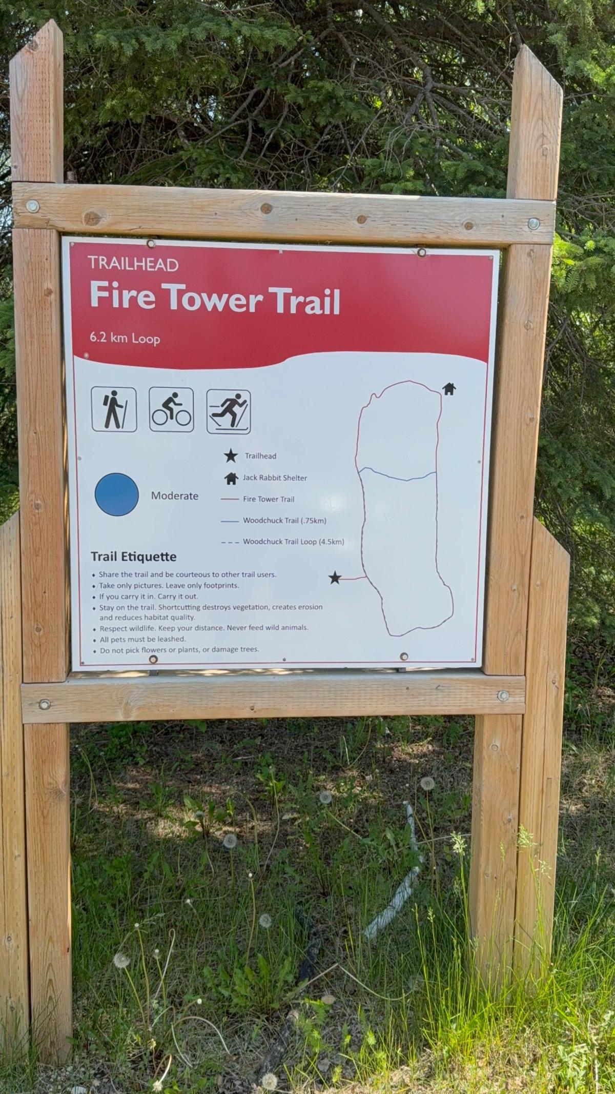
  • Fire Tower Trail – A short, easy path that loops near the back of the golf course. No towers to climb, just a good walk and a cool name.
Trailhead sign for Fire Tower Trail showing route options and etiquette tips.

No fire tower to climb, but still worth the loop.

  • Tamarack Ski Shelter – You can reach it with a short walk off the ski hill road. If you’re into geocaching, there’s a container hidden nearby (GC4D03P). Not a full hike, but still a little adventure.

And for the truly committed, there’s even a cache hidden on an island in the middle of Madge Lake (GC2CHKR). Bring a canoe, or a very brave friend.

Bonus Ella-vation Tip: Green Lake in winter hits different. Bring mitts and a thermos.

Coming Up Next…

In the next Madge Moments blog, we’re hitting the road, literally. I’ll be sharing highlights from the scenic route to Madge from Regina, with some trail stops and prairie towns you won’t want to skip along the way.

Until then, grab your bug spray, charge your phone, and let me know which Madge trail is your favourite. And hey, if you spot a damselfly, send me a pic. I need closure.


This article is part of the SaskTrails Storyteller Series. Thank you to the Saskatchewan Parks and Recreation Association and Trans Canada Trail for supporting this initiative.

Ella Gidluck is the Saskatchewan Trails Association’s 2025 Summer Storyteller. She’s a university student with a love for quiet places, trail snacks, and telling the stories behind the paths we walk.
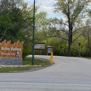
Entrance sign at Echo Valley Provincial Park surrounded by trees

Echo Valley – Built by Heart, History, and Hikers

ELLA-VATED TRAILS

Tracing prairie trails through memory, discovery, and home.

By Ella Gidluck, SaskTrails Storyteller


Until now, Echo Valley Provincial Park had always been somewhere I drove past, not into. I thought I was coming for a quick volunteer trail cleanup. I didn’t expect to walk away with a map, a few new trail names in my head (Badger, Owl, Raccoon) and a story about legacy, accessibility, and the quiet power of community.

This isn’t just a beautiful place to hike. It’s a place that’s been shaped by people who care.


“We all just pitch in.” – Rick, Trail Volunteer

Echo Valley trailhead sign with trail names

Trail names like Badger, Owl, and Raccoon greet you right from the start.

Rick met me in the parking lot, bright-eyed and fully geared up. He’s one of the folks behind the Echo Valley trail system as it exists today. He mapped routes with GPS (and a little help from the deer), organized cleanups, and added signage so you don’t get lost out there.

“We started from scratch. I just wanted a place to run, but I couldn’t maintain it all by myself… Now we’ve got over 1,000 people in the Facebook group.”

Rick, longtime volunteer at Echo Valley, standing on the trail

Rick, one of the original volunteers behind Echo’s current trail system.

He walked me through trail history like a local legend, pointing out how certain names came to be:

  • Badger Trail: “It’s the gnarliest one. Badgers are gnarly.”
  • Owl Trail: Named after the owl that swooped across the trees mid-run.
  • Rock Garden: A glacial bed of giant boulders you pass near the bottom of Badger Trail.

His favourite? “Definitely Badger. Down the hill, up through the bridges, past the glacier rocks. It’s got everything.”

Small wooden trail sign that reads 'Beware of Troll'

Echo Valley trail wisdom: come for the views, beware of trolls.

Rick also talked about how they’ve added “You Are Here” signs, color-coded markers, and community-friendly maps to help people explore safely. No app required. “We thought the techy people would scan the QR codes. Turns out, they just take pictures,” he laughed.


“This is your backyard.” – Shelly, Park Manager

Shelly, the park manager, talked to me about Echo’s bigger vision. It’s a legacy being built one trail and tree at a time. She told me how local school kids from Standing Buffalo, Pasqua First Nation, and Fort Qu’Appelle helped plant over 100 trees in the park last fall. They named them too — Leafy, Superman, Scotty (the Scots Pine). Elmer (the Elm), Sparkles.

“We want people to feel like this is theirs to protect, but also theirs to enjoy.”

Shelly shared Echo’s upcoming accessibility plans: a new all-persons trail close to the campground. Not paved, but solid-surfaced with minimal elevation changes, it’s built for walkers, wheelchair users, and anyone needing a more stable path.

“Right now, we don’t have a fully accessible trail. But we’re working on it.”

Framed photos from the 1980s Girl Guide Jamboree on display in the visitor centre

Framed slides from the 1980s Girl Guide Jamboree, still on display in the visitor centre.

Echo is also preserving its past, like a set of slides from the 1980s Girl Guide World Jamboree when over 3,500 Girl Guides camped right in the valley. One photo shows kids playing wheelchair volleyball — proof that Echo was thinking about accessibility long before it became a buzzword.


From Glacial Boulders to Girl Guides

Echo Valley is full of these unexpected stories. A trail system partly designed by following deer paths. A running race that doesn’t stop until everyone but one drops (yes, really — Rick calls it the “Backyard Ultra”). A park with one side reserved just for nature-based recreation to keep the valley wild for future generations.

“We’ve got people out here who care as much about the park as I do,” Shelly said. “That’s when cool things happen.”


If You Go

  • Start with Deer Trail if you’re new or bringing kids. It’s flat, shaded, and loops around with a great valley view.
  • Looking for a challenge? Try Badger Trail. You’ll find bridges, coolies, and the legendary Rock Garden.
  • Stop by the visitor centre and ask about the Girl Guide slides.
  • If you see a tree named Sparkles… give her a little wave.
Echo Valley trail with trees opening into a clear walking path

The kind of view that makes you slow down, breathe deep, and stay a little longer.


My Ella-vated Trail Ratings

5/5 Trees Named by Kids Who Totally Got It Right
Looking at you, Sparkles.

4.9/5 “You Are Here” Signs That Prevented a Panic Spiral
The other 0.1 is on me, not the map.

5/5 People Who Showed Up Because They Care
And somehow made trail cleanup feel like a party.

Echo Valley Provincial Park trail map showing all trail names and routes

Here’s your go-to trail map to start planning your Echo adventure. Don’t worry—they’ve added “You Are Here” signs too.


Read more trail stories and enter the 2025 Photo Contest at sasktrails.ca

This article is part of the SaskTrails Storyteller Series. Thank you to the Saskatchewan Parks and Recreation Association and Trans Canada Trail for supporting this initiative.

Ella Gidluck is the Saskatchewan Trails Association’s 2025 Summer Storyteller. She’s a university student with a love for quiet places, trail snacks, and telling the stories behind the paths we walk.
2025 Give Us Your Best Shot Photo Contest

📸 Give Us Your Best Shot: 2025 Trail Photo Contest

Your camera roll already knows… Saskatchewan’s trails are full of beauty, adventure, and moments worth capturing.

Now’s your chance to share your favourite trail photos and win some seriously cool outdoor gear. Whether you’re hiking, paddling, biking, or just out for a scenic walk, we want to see how you experience the trails.

🗓 Entries open June 1 and close June 30, 2025.


🏆 How to Enter

You can submit your photos in three easy ways:

  • Post to Instagram, Facebook, or X (formerly Twitter) using #GiveUsYourBestShot2025
  • Email your photo to info@sasktrails.ca
  • Upload directly through our Google Form submission portal

Please include where the photo was taken in your caption or submission.
Make sure your posts are public so we can see them!

There’s no limit to how many photos you can submit—just make sure each one is uniquely awesome.


 What We’re Looking For

We want to see trail life in all its forms.

  • An action-packed cycling moment
  • A peaceful paddle on glassy water
  • Kids chasing bugs down a forest path
  • Your dog doing something goofy in a meadow

Big moments or small—if it captures the spirit of the trails, we want to see it.


🎁 2025 Prize Categories

All entries will be considered in one of the three categories below. You do not need to specify which—our board will review and place submissions accordingly.

🧭 Best Action Shot – Adventure Bundle

  • Mustang APF PFD
  • Katadyn BeFree Water Filter
  • Morakniv Knife
  • UCO Fire Striker
  • Tinder-on-a-Rope
  • 100 ft Paracord

🌄 Best Scenery Shot – Chill Trail Bundle

  • Eureka Tagalong Lite Chair
  • Gooder Sunglasses
  • Fresh Air Hat
  • Granite Gear Hiker Wallet
  • Shemagh Scarf
  • Nalgene Bottle
  • Waterproof Phone Case

🎲 Random Draw – Trail Starter Pack

  • Cotopaxi Fanny Pack
  • Fresh Air Hat
  • Waterproof Phone Case
  • UCO Switch Spork

A huge shout-out to our prize partners:
Stapleton’s Great Adventure Company and Fresh Air Experience for generously supporting this year’s contest. Thanks for helping us gear up Saskatchewan’s trail lovers!


⚠️ Rules + Legal Notes

  • Open to all Saskatchewan residents
  • STA board and staff may enter, but are not eligible to win
  • By submitting a photo, you give Saskatchewan Trails Association permission to use it in promotional materials (social media, reports, brochures, website, etc.)
  • You must own the rights to your photo and have permission from anyone clearly visible in the image
  • Private posts or submissions we cannot access will not be considered
  • Submit the highest resolution possible

🏁 Deadline

All entries must be submitted by June 30, 2025 at 11:59 PM CST.
Winners will be selected by our board and announced in early July.


Whether you’re snapping memories on your next big adventure or rediscovering a favourite trail close to home—
Give Us Your Best Shot.

The swinging bridge in Wolseley stretches over calm water with wooden planks and chain-link sides, surrounded by trees and homes.

Not Far, Not Long, Just Right: Wolseley and Whitewood

Welcome to the Trail

Ella-vated Trails

Tracing prairie trails through memory, discovery, and home

Ella Gidluck standing in front of colorful spring flowers and trees, smiling at the camera

Hi, I’m Ella. I’m a storyteller, a curious beginner, and someone who’s spent most of her life in Saskatchewan without realizing how many trails are waiting to be explored. This summer I’m setting out to change that.

As the Trail Storyteller with the Saskatchewan Trails Association, I’ll be travelling across the province to walk, watch, listen, and share. I’ll be posting updates here through trail reflections, short videos, photos, and conversations with the people who love these places and keep them alive.

Some stories will be playful. Some will be quiet. All of them will come from real moments on real paths.

Whether you’re someone who hikes every weekend or just likes to follow along from the comfort of home, I’m glad you’re here. Let’s see where the trail leads.

About Ella

Ella Gidluck is a student, writer, and the 2025 Trail Storyteller with the Saskatchewan Trails Association. Born and raised in Saskatchewan, she is spending the summer exploring trails across the province and sharing the stories she finds along the way. With a camera in hand and a curious mindset, she is drawn to the quiet details, the local voices, and the feeling of discovering home all over again.

Experience the Trails in Danielson Provincial Park 

Experience the Trails in Danielson Provincial Park 


Danielson Provincial Park is located at the northern end of Lake Diefenbaker in the southern part of the province.  The park surrounds the Gardiner Dam, which was built in 1967 and is among the largest embankment dams in Canada and the world.  

The South Saskatchewan River flows north beyond the park, towards Outlook and Saskatoon. Saskatchewan Highways 44, 45, and 219 provide access to the park. SaskPower’s Coteau Creek Hydroelectric Station is near the park. 

The park opened to the public in 1971 and was named for former MLA Gustaf Herman Danielson.                   

Danielson Provincial Park’s Visitor Centre is located between Lake Diefenbaker and Coteau Bay and features numerous interactive displays about the Gardiner Dam and the river systems of southern Saskatchewan in addition to a café and beach. 

Danielson Provincial Park is home to several trails including the Trans Canada Trail. All of the trails are  designed for hikers, cyclists and mountain bikers. In the winter they can be used for cross country skiing and snowshoeing. 

The Trans Canada Trail provides users with breathtaking views of various landscapes, including wetlands, shoreline views of Lake Diefenbaker, wooded areas, native prairie and large coulees.  

The Prairie View Nature Trail follows a looped pathway that connects back to the park’s campground. Cyclists and mountain bikers are asked to watch out for pedestrians and use caution as parts of the trails can become quite sandy, making them more difficult to ride through. Visitors may also come across a variety of wildlife and bird species while on the trails. Jackrabbits, western meadowlarks, deer, coyotes and sharp-tail grouse are just some of the species you may see this year. 

The Plantation Loop Trail: Another option for a shorter hike along the Plantation Loop Trails, which is 1.2 kilometers long and provides a pleasant walk through the park’s natural beauty. 

The Overflow Trail is a five-kilometer trail that offers a bit more of a challenge and takes you through various terrains.  

While you are in the area, you may want to visit the Elbow Trail, which links to the Trans Canada Trail. This trail is situated near the town of Elbow, and this proximity to the lake provides beautiful views and opportunities for water-related activities. 

The trail is relatively flat and easy to navigate, making it suitable for hikers of all skill levels. It’s a gravel path, which is great for walking, running, and cycling. The area around the trail is rich in wildlife and natural beauty. You might spot various bird species, small mammals, and a variety of plant life. The trail is accessible year-round, though the best times to visit are during the spring, summer, and fall when the weather is more favorable. 


If you are interested in more information, visit these sites:  

Danielson Provincial Park | Tourism Saskatchewan 

Trans Canada Trail | Where to Find Stunning Lake Views in Saskatchewan (tctrail.ca) 

This article is part of the SaskTrails Storyteller Series. Thank you to the Saskatchewan Parks and Recreation Association and Trans Canada Trail for supporting this initiative. 


Experience the Sand Beneath Your Feet


Experience the Sand Beneath Your Feet

If you want to experience the sand beneath your feet on a walking trail, then make sure you visit the Sand Hills Trail in Douglas Provincial Park. It is not as well-known as the Great Sandhills near Sceptre, but it is a fantastic destination for nature lovers and hiking enthusiasts. It’s like going for a walk in the desert without having to leave the province! 

The Sand Hills Trail is part of the larger Sand Dunes Loop, which is about 9.3 kilometers long. It’s generally considered a moderately challenging route, taking around 1 hour and 54 minutes to complete. You will need to complete the loop to view    the sand hills. Once you are in the sand, you are free to roam around the discover this unique terrain. 

The trail offers stunning views of massive sand dunes, which tower about 25 meters over the surrounding grasslands. These dunes are constantly shifting with the wind, creating a dynamic and picturesque landscape. 

As you hike, you’ll encounter a variety of habitats, including aspen woodlands, prairie landscapes, and lush, forested areas near the lakeshore. This diversity makes it a great spot for birdwatching and observing local wildlife. 

The best time to visit is from June through September. The trail is well-marked, but it’s recommended to bring ample drinking water and wear proper footwear, as there is little shade along the way

The Sand Sunes Loop also includes the Cacti/Dune Trail and the Sunset Hiking Trail, which each offers unique experiences and scenic views 

The Cacti Trail portion is 5 km, and the Dune portion is 6.5 km. This trail takes you through diverse habitats, including areas with cacti and the picturesque sand dunes. It’s known for its moderate-to-hard difficulty level and can take about two to three hours to complete. You’ll encounter the park’s main natural features, such as the large, constantly moving sand dunes and isolated clusters of rich, aspen woodlands. 

Sunset Hiking Trail is an approximately 2 kilometer a loop. It is rated easy, suitable for hikers, cyclists, and even wheelchairs. This trail offers a diverse range of habitats, including moist meadows and lush woodlands. You’ll find forested areas near the lakeshore, where underground streams create lush, forested areas. It’s a great spot for birdwatching, especially in the early morning. Interpretive panels along the trail enhance the hiking experience by providing information about the local flora and fauna. 

Whether you’re looking for a peaceful walk or a more challenging hike, the Sand Hills Trail has something to offer.  

If you are interested in more information, visit these sites:   

 Douglas Provincial Park Sand Dunes, Saskatchewan, Canada – 101 Reviews, Map | AllTrails 

Douglas Provincial Park Trails | Tourism Saskatchewan 

Sand dunes in Saskatchewan! – Douglas Provincial Park, Elbow Traveller Reviews – Tripadvisor 

Tour Park Detail – Douglas Provincial Park, Saskatchewan – Saskatchewan Provincial Parks 

Katee Pederson – Douglas Provincial Park 

 This article is part of the SaskTrails Storyteller Series. Thank you to the Saskatchewan Parks and Recreation Association and Trans Canada Trail for supporting this initiative. 


Northeast Swale: Connecting with the Past and Growing Our Future

Northeast Swale: Connecting with the Past and Growing Our Future

The Northeast Swale (Swale) is in the northeastern area of Saskatoon, adjacent to Aspen Ridge, and has long been regarded as a unique environment, having ecological, hydrological and hydrogeological characteristics. 

It is a natural and cultural connection to the past and future of Saskatchewan. With less than 5% of plains rough fescue grasslands remaining in the world, the swale landscape is unique to both Saskatchewan and worldwide. 

The Swale offers high quality biodiversity, proximity to urban areas, economic benefits for education and recreation, and a natural filter for our air and water. Its diverse environment offers a habitat for a large variety of plant species (more than 200), birds (more than 100), mammals, amphibians, reptiles and insects, and provides flood control for the surrounding community. 

The City of Saskatoon (City) and the Meewasin Valley Authority (Meewasin) have partnered to conserve the portion of the Swale located in both the City’s boundary and Meewasin’s Conservation Zone.  Maintaining biodiversity within the Swale is crucial to maintaining resilience in this ecosystem which faces human induced and natural stresses. Biodiversity provides social, cultural and economic value through biological resources as well as a host of key ecological processes such as nutrient cycling, soil building, and management of water and air purification.  

The trails at the Northeast Swale near Saskatoon are known for their natural beauty and ease of access. Here’s what you can expect: 

  • Pet-Friendly: Dogs are welcome but must be on a leash if they are on the western section of the site, which is usually referred to as the recreation zone (where the trails are gravel). This is roughly in the area west of Range Road 3050. However, due to the environmental sensitivity of the core ecological area – the majority of the site and where the trails are mown – east of Range Road 3050, dogs are NOT permitted by city bylaw.. 
  • Environment: Expect a trail with little shade, which means it can get quite hot on sunny days. However, its well-maintained path makes it a pleasant walk. 

If you’re looking for a longer activity, the trail easily connects to nearby pathways for an extended cycle, run, or walk. The Northeast Swale is a unique environment with ecological, hydrological, and hydrogeological characteristics, offering a glimpse into the natural and cultural history of Saskatchewan. 


If you are interested, there is more information about the Northeast Swale and those who contributed to its excellence: 

Northeast Swale | Saskatoon.ca 

Saskatoon’s Northeast Swale | CPAWS Saskatchewan (cpaws-sask.org) 

The Meewasin Valley


This article is part of the SaskTrails Storyteller Series. Thank you to the Saskatchewan Parks and Recreation Association and Trans Canada Trail for supporting this initiative. 


McKell Conservation Area

McKell Conservation Area

Located in the east end of Regina, McKell Wascana Conservation Park is a great place to spend an afternoon or evening. Its interpretive signage and abundance of wildlife which makes it a great place for kids, while it also makes it a great place for a sunset. 

With its sprawling 171 acres of carefully-preserved land, this park is a testament to the beauty of Saskatchewan’s native prairie and wetland habitats. For those seeking an outdoor adventure, the park’s trails provide an unparalleled experience. 

McKell boasts 4 kilometers of groomed nature trails, each winding through diverse landscapes and offering varying levels of hiking difficulty. The trails are meticulously designed to cater to both the casual stroller and the avid hiker. 

  • The Prairie Loop: This easy trail meanders through the heart of the park, showcasing the vast expanse of the prairie. Visitors can expect a leisurely walk with minimal elevation changes, making it perfect for families and individuals of all ages.
  • The Wetland Way: A moderate trail that takes you closer to the aquatic ecosystems of the park. With boardwalks and viewing platforms, this trail offers a chance to observe the wetland’s flora and fauna up close without disturbing the delicate balance of the ecosystem.
  • The Woodland Path: For those seeking a bit more challenge, this trail offers a slightly more rugged terrain as it cuts through the dense woodlands. The path is well-marked, but the occasional incline and uneven ground call for sturdy footwear. 

This conservation park is a haven for biodiversity. The prairie grasses sway in the wind, dotted with the vibrant colors of wildflowers like the prairie crocus and the black-eyed Susan. The wetlands are home to cattails and bulrushes, providing shelter and food for the park’s wildlife. 

Birdwatchers will delight in the variety of species that call the park home. From the haunting call of the loon to the cheerful chirp of the chickadee, the park’s bird life is rich and varied. Migratory birds often stop at the park, making it a prime spot for sighting rare species. 

The park is also home to an array of mammals, reptiles, and insects. White-tailed deer can be spotted in the early mornings and late evenings, while garter snakes bask in the sun along the trails. Butterflies flutter among the flowers, adding a splash of color to the greenery. 

A visit is an opportunity to reconnect with nature. The entry plaza welcomes visitors with educational displays, setting the tone for an informative and enjoyable visit. The amphitheater hosts various programs, allowing guests to learn about the park’s conservation efforts and the importance of preserving natural habitats. 

The dock, currently being refurbished, is a favorite spot for pond dipping, where children and adults alike can discover the aquatic life that thrives below the surface. Benches are strategically placed along the trails, providing spots to rest and reflect. 

The park was made possible through a conservation easement which was donated by the McKell family: Robert, Barbara, Doug and Shirley McKell. Through this agreement, the owners of the land donate or sell certain property rights specific to conservation efforts such as their rights to subdivide or develop the land. 

Even if the land is passed down or sold, the conservation agreement remains legally binding, which ensures the protection and conservation of the land. As one of the plaques states: “By placing this conservation easement on their land, (now the southern portion of the park), the McKell family is preserving this natural area for wildlife and people to enjoy today and leaving a legacy for generations to come.” 

Whether you’re a seasoned hiker or a family looking for a weekend outing, the park’s trails offer something for everyone. With each step, visitors are reminded of the delicate beauty of our natural world and the responsibility we share in its preservation. So lace up your boots, grab your binoculars, and embark on a journey through one of Regina’s most cherished natural landmarks. 

If you are interested, there is more information about the McKell Wascana Conservation Park and those who contributed to its excellence: 

McKell Wascana Trail, Saskatchewan, Canada – 14 Reviews, Map | AllTrails
http://www.ducks.ca/places/saskatchewan/mckell-wascana-conservation-park/
https://www.nature.org/about-us/private-lands-conservation/conservation-easements/what-are-conservation-easements.xml 

Discovering McKell Wascana Conservation Park | Saskatchewan Trails Association (sasktrails.ca) 

Walk in the McKell Wascana Conservation Park (maruniku.ca) 


This article is part of the SaskTrails Storyteller Series. Thank you to the Saskatchewan Parks and Recreation Association and Trans Canada Trail for supporting this initiative. 

For a Great ATV Experience

For a Great ATV Experience

Hey, ATV enthusiasts! 

Well, the weather warms up, ATV enthusiasts are looking forward to spending more time outside. Now is the time to remind the public to think about safety  while enjoying this season.  


ATVs are a great way to experience the Saskatchewan outdoors. Riding an ATV allows you to explore off-road trails, forests, and scenic landscapes that you might not otherwise experience. ATVs are amazing, but we should always be keeping ourselves and others safe. 

Following these guidelines will ensure that you make it home safe and sound; 

  1. Wear the gear. Saskatchewan law requires that all ATV riders (including passengers) wear a helmet and goggles (if the helmet doesn’t have a face screen) on public property or on property that the rider does not own. This includes side by side. Roll cages are not foolproof and in a roll over the driver’s head can meet the roll cage or other part of the side by side resulting in serious head injuries.
  2. Do not allow passengers unless the ATV is designed to carry a passenger. Single person ATVs are designed with a specific center of gravity and adding a passenger can create a dangerous imbalance in the ATV, especially when climbing or maneuvering around obstacles.
  3. The Right ATV – this is especially true for children. ATV’s will have warning labels which advise what minimum age is appropriate for riding that ATV. Placing a child or small person on an ATV that is too large or powerful for them to handle can have dire consequences.
  4. Get Trained – it’s important that riders know how to ride their ATV properly. If the rider is 12 to 15 years old or does not have a driver’s license they must take an approved safety course. However, all riders can benefit from the training.
  5. Ride with a Buddy/Group – at the very least make sure someone knows where you are and when you are expected to come back. Riding with friends or a group makes for a more enjoyable experience and provides additional security in knowing that someone else is there should there be a mishap.
  6. Know your Limits – attempting advanced or tricky maneuvers, without the proper experience and training, can lead to crashes, and resulting injuries.

This article is part of the SaskTrails Storyteller Series. Thank you to the Saskatchewan Parks and Recreation Association and Trans Canada Trail for supporting this initiative.