Wanuskewin entrance sign surrounded by open prairie

More Than a Trail: A Day at Wanuskewin

ELLA-VATED TRAILS

Exploring Saskatchewan trails through storytelling, small adventures, and occasional navigational failure.

By Ella Gidluck, SaskTrails Storyteller

More Than a Trail: A Day at Wanuskewin

Wanuskewin was not originally part of my Saskatoon-area itinerary.

Once I realized how close it was to Warman, though, it felt silly not to make time for one more stop before heading home.

My grandma joined me again, and we arrived around 11 a.m. with a plan: explore the trails before the afternoon heat really set in, grab lunch at the on-site restaurant, spend some time in the exhibits and stay for the daily cultural presentation.

It ended up being one of the most memorable stops of the trip.

First Impression: Cool Bison

Before heading onto the trails, we passed a series of bison sculptures near the Visitor Centre.
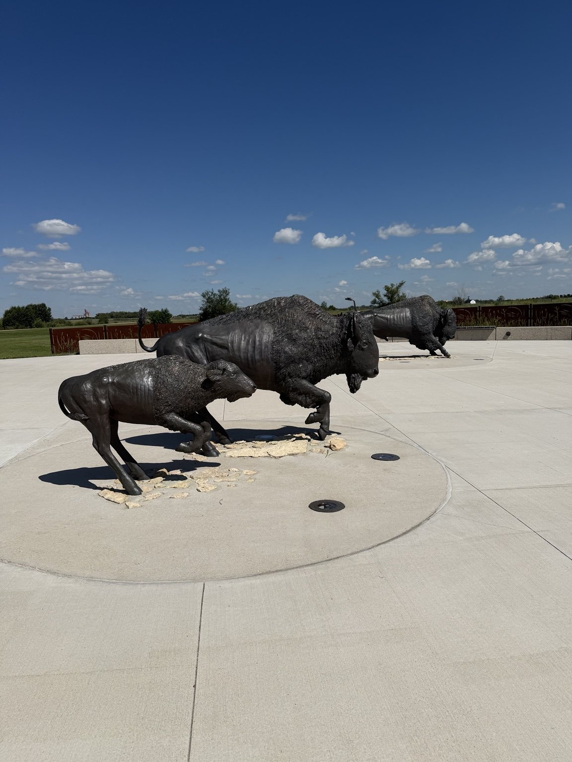
Bison sculptures near the Wanuskewin Visitor Centre
At this point in the day, we did not yet understand the whole scene.

My grandma suggested we take a photo with them. At the time, I mostly registered them as very cool bison sculptures.

That changed later.

Down Into the opimihāw Valley
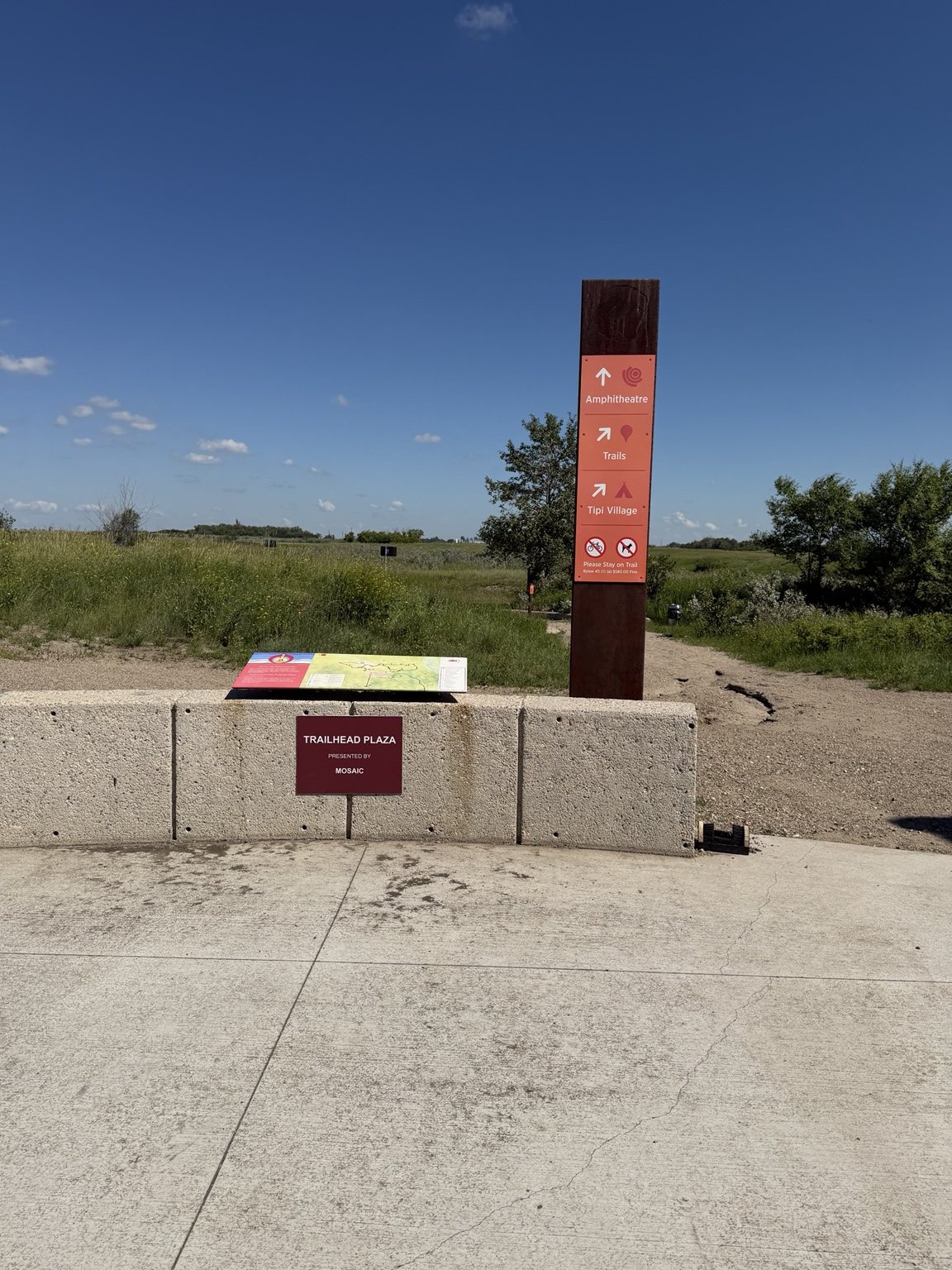
Wanuskewin trailhead plaza with directions to trails, tipi village and amphitheatre

Wanuskewin has a nearly seven-kilometre trail network through the opimihāw Valley, with routes that vary in distance and difficulty.

We took our time, partly because it was another scorching summer day and partly because my grandma and I are physically incapable of walking past an interpretive sign without reading the entire thing.
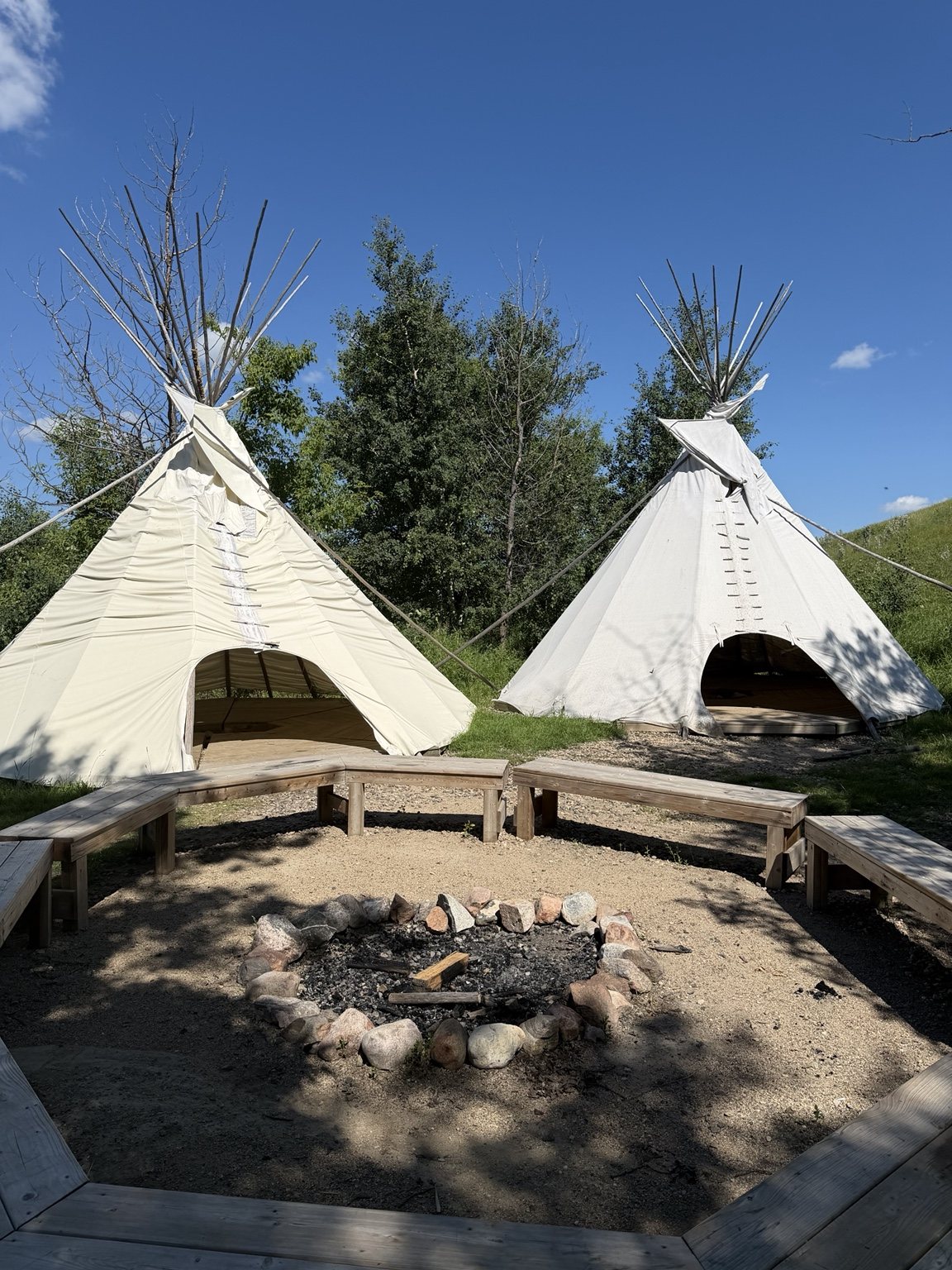
Tipis and gathering area in the Wanuskewin valley

The terrain changed constantly. We moved through open prairie, thick vegetation, creek-side sections, bridges and hills that made us work for the views.
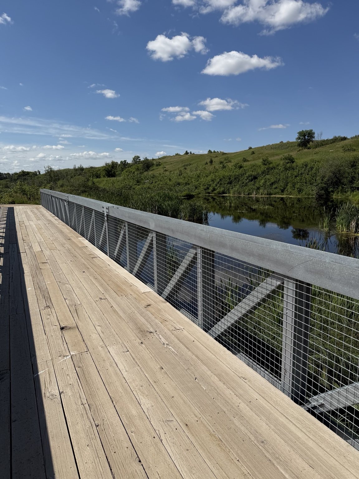
Wooden bridge crossing a creek in the Wanuskewin valley
One of my favourite parts of the trail. Also a useful landmark when you later realize how far you have walked.

Some sections were easier than others. In the heat, Grandma and I took breaks on the hills and kept moving at our own pace.
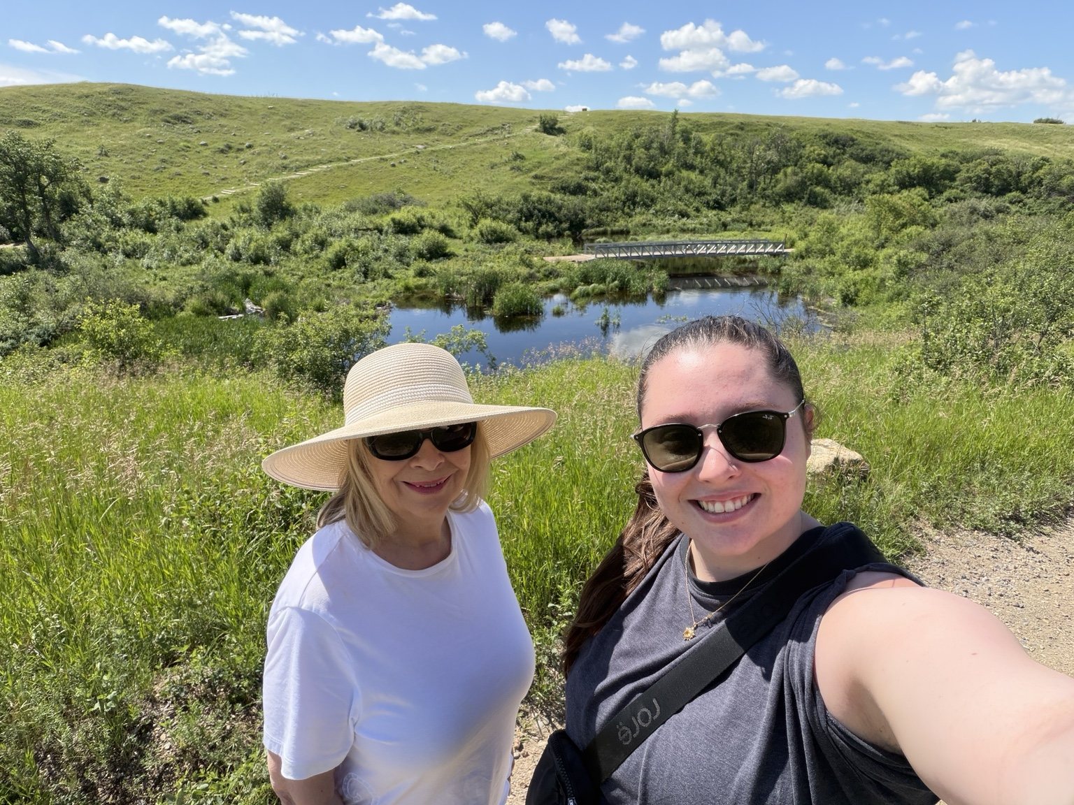
Grandmother and granddaughter on the Wanuskewin trail overlooking the valley
Grandma and me, taking our museum-reading habits outdoors.

One of my favourite moments was reaching a lookout and being able to spot the bridge below. You could physically see how far you had travelled through the valley.

Learning the Story in the Landscape

The interpretation along the trails is what made Wanuskewin feel different from every other stop on the trip.

At the opimihāw Bison Jump, the signs walked us through how Northern Plains Indigenous peoples used the shape of the landscape during communal bison hunts. The interpretation explained the roles people took on, the formation used to guide the herd and the relationship between people, bison and the land.

Wanuskewin’s July programming similarly describes the bison jump interpretation as a way to explore the relationship between Northern Plains Indigenous peoples and the environment around them.

Because the story was being explained in the exact landscape where these practices took place, it felt much more immediate than reading the same information on a wall somewhere else.

Then It Clicked

When we came back toward the Visitor Centre, we passed the sculptures again.

This time, we understood what we were looking at.

The arrangement of the bison and people was recreating the bison-jump story we had just learned on the trail. The figures behind the rocks, the positioning and the movement of the herd suddenly made sense.

It was one of those excellent museum-brain moments where information you learned twenty minutes earlier changes what you see in front of you.

We also picked up a vocabulary correction during the visit. The animal I had casually been calling a buffalo is a bison. Consider me educated.

The Bison Viewing Area, Minus the Bison
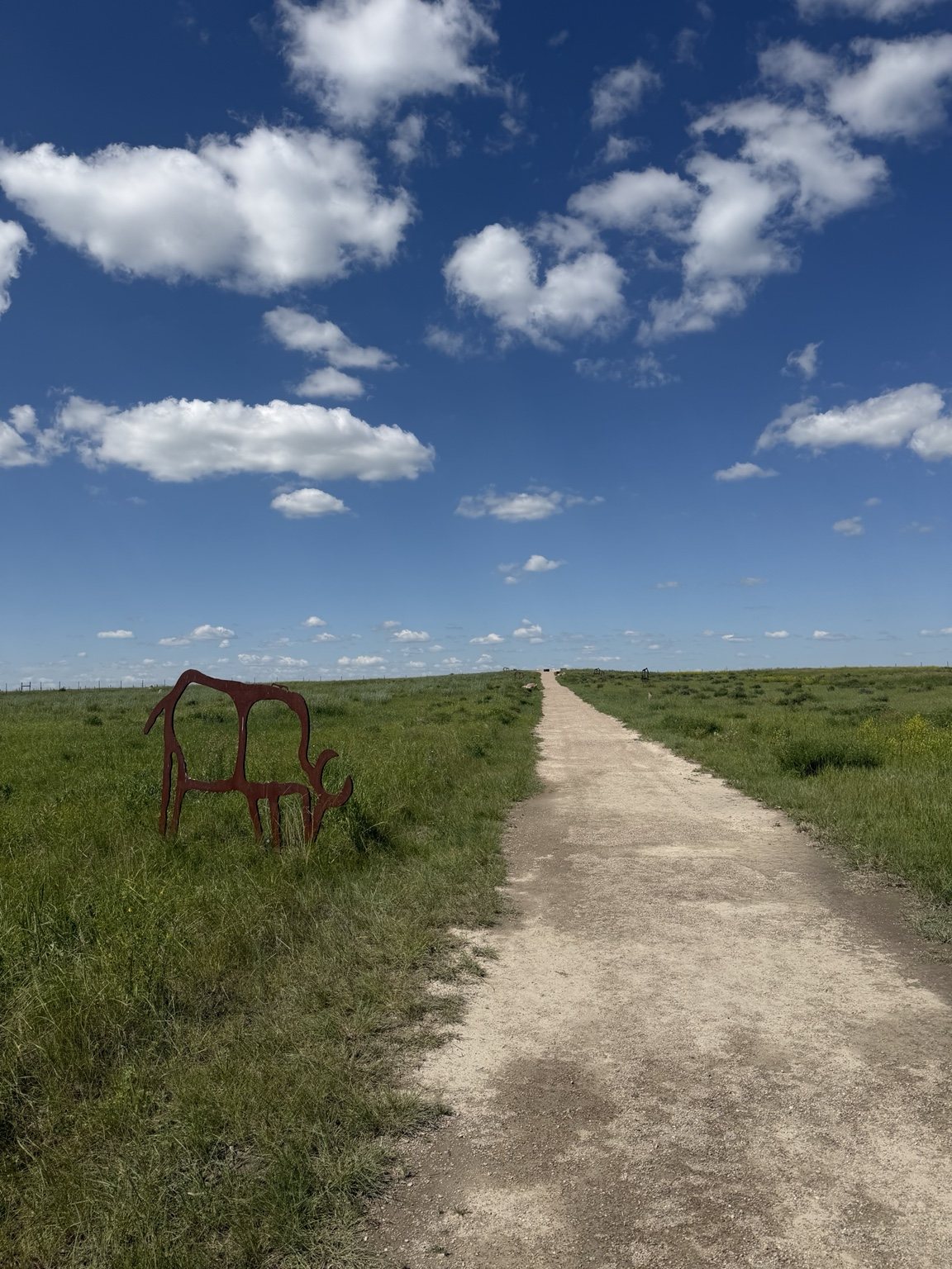
Open prairie trail at Wanuskewin lined with bison silhouettes

We also walked out toward the bison viewing area.

My grandma had warned me that there was never a guarantee we would see the herd because they have a large area to roam, so expectations were managed.

Still, we were a little disappointed when there were no bison in sight.

We could see construction in the distance and wondered if that had something to do with it. Later, I learned the herd had been temporarily moved during the construction period.

At least they had a better excuse for skipping the hike than I did at Blackstrap.

Lunch, Museum Time and Saskatchewan Sarsaparilla

By that point, lunch sounded excellent.

We headed back inside and ate at the on-site restaurant, where we had bannock, I ordered a bison melt, and we tried Saskatchewan-made sarsaparilla.

The sarsaparilla was unlike anything I had tried before, which made it a fun little addition to a day already built around learning and trying new things.

After lunch, we went through the museum and art gallery.

Wanuskewin’s facility is exceptionally well done. The exhibits connect archaeology, treaties, bison, art, culture and contemporary Indigenous life, and there is enough information to keep people like us occupied for a dangerous amount of time.

For context, my grandma and I are the type of people who can spend eight hours in a museum and emerge confused about why everyone else left.

A Circle, a Hoop Dancer and Visitors From Everywhere

At 1 p.m., we joined Wanuskewin’s daily dance and music presentation. The summer program features dancers, drummers and musicians sharing their art form and stories with visitors.

Our presenter was hoop dancer Lawrence A. Roy Jr.

We sat in a circle while Lawrence shared stories and talked about circles and connectedness. He pointed to the circles that appear throughout life and culture, including the earth, foods, the cycle of life and the medicine wheel.

Then he danced.

And kept adding hoops.

And adding hoops.

By the end, the number of hoops involved felt frankly unreasonable.

His three children were there watching him, and the presentation felt intimate and personal rather than distant or staged. Lawrence also asked everyone where they were visiting from.

People had come from all over the world.

That stuck with me.

The Conversation on the Drive Home

On the drive back to Warman, my grandma and I talked about what we had learned.

She reflected on how little First Nations history she had been taught growing up and how much she appreciates opportunities to learn now.

We both appreciated that Wanuskewin acknowledges painful parts of history without allowing those tragedies to become the entire story.

The experience also centres culture, knowledge, art, family, land, resilience and continuity. The people and cultures being interpreted at Wanuskewin are not presented as something that only existed in the past.

That mattered to us.

I had gone to Wanuskewin because it was close by and had trails.

I left feeling like the trails were only one part of the experience.

They connected the landscape to the stories, and the stories changed the way we looked at the landscape.

Before You Go

  • Give yourself more time than you think you need if you like museums and interpretive signs.
  • The trail difficulty varies, and some valley climbs can feel substantial in hot weather.
  • Check the day’s public programming before you arrive and build your visit around it.
  • Do not assume you will see the bison on every visit.
  • Try the restaurant. Bannock and Saskatchewan-made sarsaparilla were excellent additions to the day.

Ella-vated Trail Rating

Category Rating Notes
Trail + Learning Combo 10/10 You are not just walking through the landscape, you are learning how to read it.
Interpretive Signage 10/10 Grandma and I read everything. Casual museum behaviour remains unavailable.
Valley Views 10/10 The bridge and lookout made the climbs completely worth it.
Hill Effort in 30°C Heat 8/10 Gorgeous, but the valley does eventually make you earn your way back out.
Bison Spotting Success 0/10 The bison had been temporarily relocated. Extremely valid excuse, still no bison.
Bison Jump Lightbulb Moment 11/10 Walk past the sculptures, learn the story, come back and suddenly understand the whole scene. So good.
Lunch Experience 10/10 Bannock, bison melt, Saskatchewan-made sarsaparilla. No notes.
Hoop Dance Presentation 10/10 Lawrence A. Roy Jr., an alarming number of hoops, and a really memorable conversation about circles and connectedness.
Museum Sponge Potential dangerous You could lose an entire day in there if you are the type to read every label. We are.
Final Ella-vated Rating 10/10 The most complete stop of the trip. Trails, culture, food, history, art and a genuinely memorable afternoon.

Wanuskewin was the last-minute addition to the itinerary.

It ended up being the stop I am happiest we squeezed in.

This article is part of the SaskTrails Storyteller Series. Thank you to the Saskatchewan Parks and Recreation Association and Trans Canada Trail for supporting this initiative.

Ella Gidluck is the Saskatchewan Trails Association’s 2026 Summer Storyteller. She’s on a mission to prove Saskatchewan trails are cooler than people think, even when the mosquitoes disagree.
Colourful reconciliation mural created by Kevin PeeAce with Humboldt youth

Finding the Trails in Humboldt

ELLA-VATED TRAILS

Exploring Saskatchewan trails through storytelling, small adventures, and occasional navigational failure.

By Ella Gidluck, SaskTrails Storyteller

Finding the Trails in Humboldt

Not every trail trip begins with a perfectly marked trailhead and a carefully planned route.

My grandma and I arrived in Humboldt knowing we wanted to explore the community and find some local walking trails.

Exactly which trails we were supposed to find was another question.

So we started downtown.

That decision turned out to be one of the best parts of the day.

Accidental Public Art Tour

Around City Hall and the surrounding blocks, we kept finding public art, gardens, memorials and little community details that made us stop and look.

One of the first was the reconciliation mural created by Kevin PeeAce with Humboldt youth. From there, we wandered through the Heritage Garden and kept finding more.

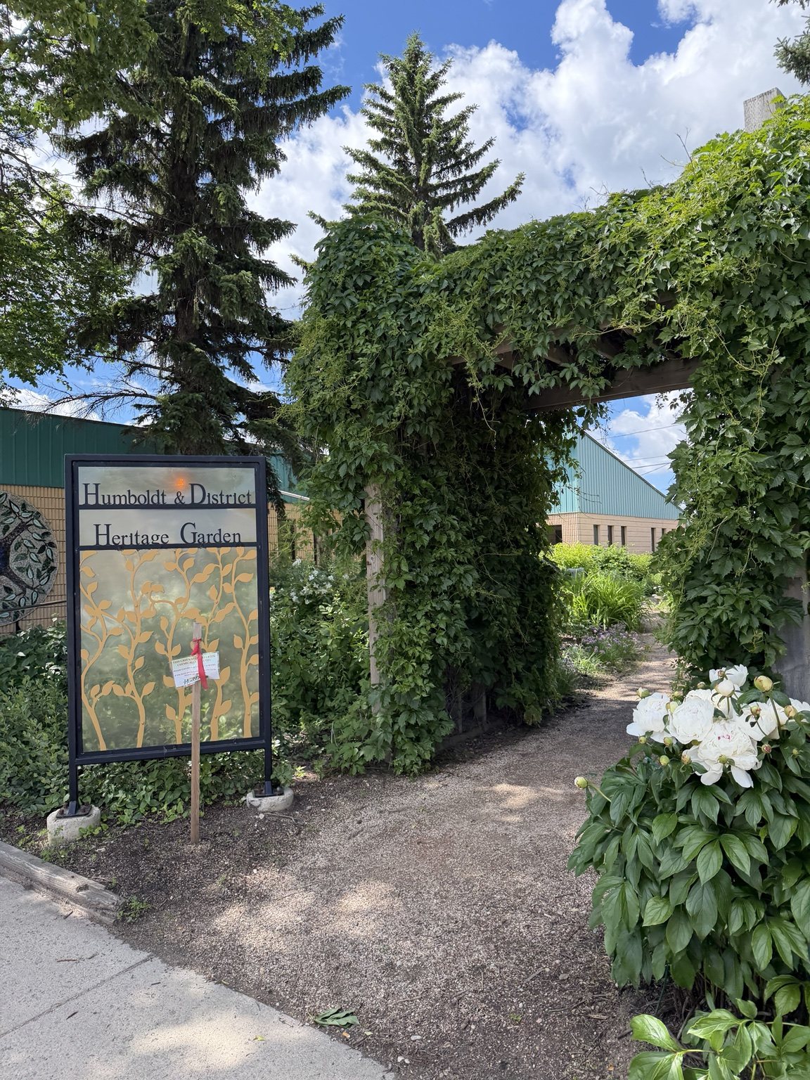
Entrance to the Humboldt and District Heritage Garden

The garden is the kind of compact public space that keeps rewarding nosiness. Flowers, benches, murals, painted stones and community projects are tucked into a surprisingly small area.

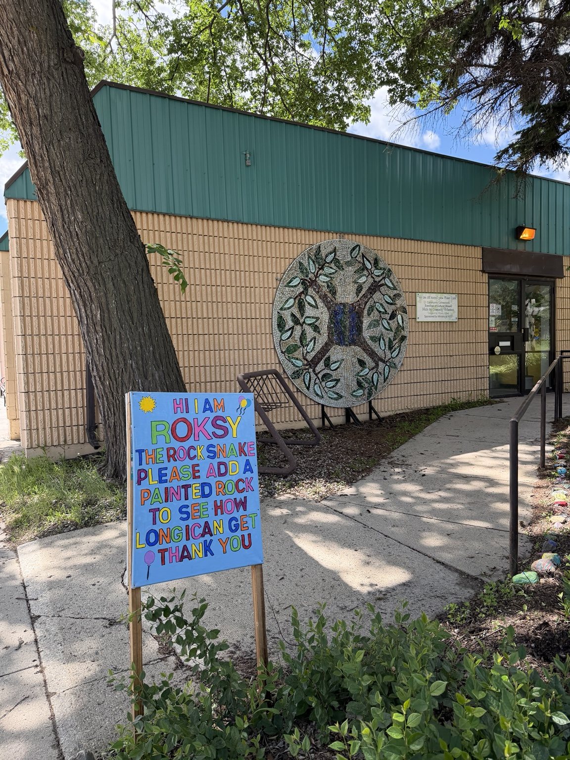
Roksy the Rock Snake sign beside the community painted-rock trail
Roksy. Obviously.

Then we kept walking.

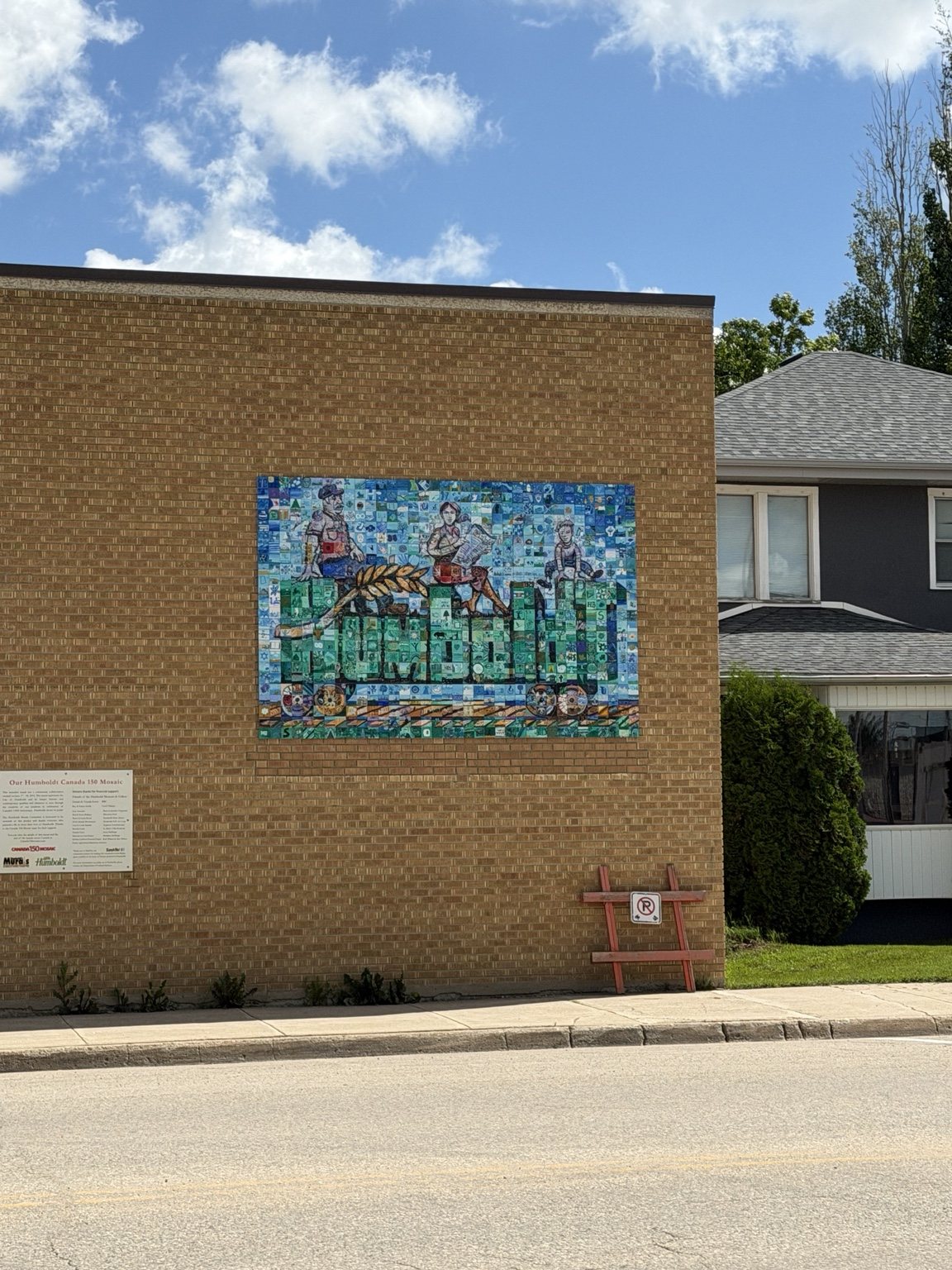
Humboldt Canada 150 community mosaic mounted on a downtown building

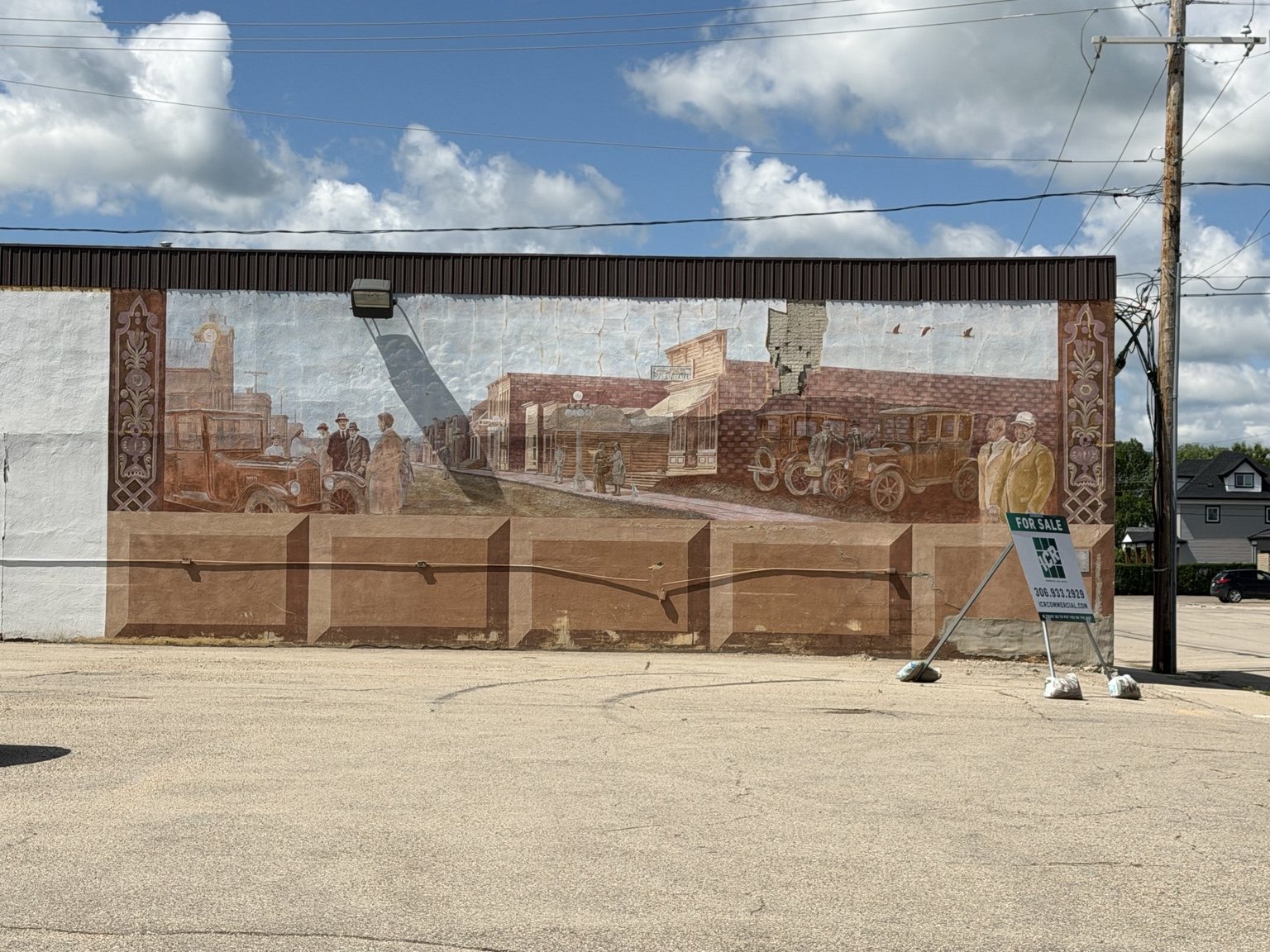
There were community mosaics, decorative crosswalks and historic murals throughout the downtown area. We had technically come to Humboldt looking for trails, but the town itself had already turned into a pretty good walking route.

Large historic mural depicting an early Humboldt streetscape

Grandma Clocks Out of Lunch Duty

After several packed lunches over the weekend, Grandma deserved a break from meal prep.

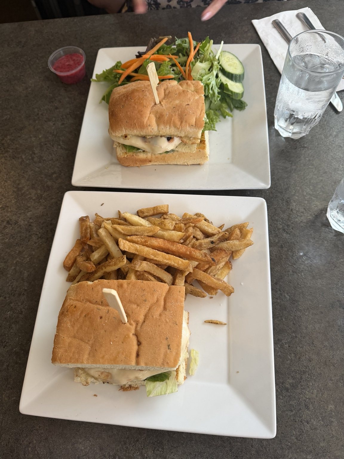
We went to Johnny’s Bistro and had an actual sit-down lunch.

Sandwiches, salad and fries served at Johnny's Bistro in Humboldt
We had been very responsible with our packed lunches. This was our little treat.

It was excellent.

Then came the real question.

Where the heck were the trails?

We Found a Trail. Was It the Trail? Great Question.

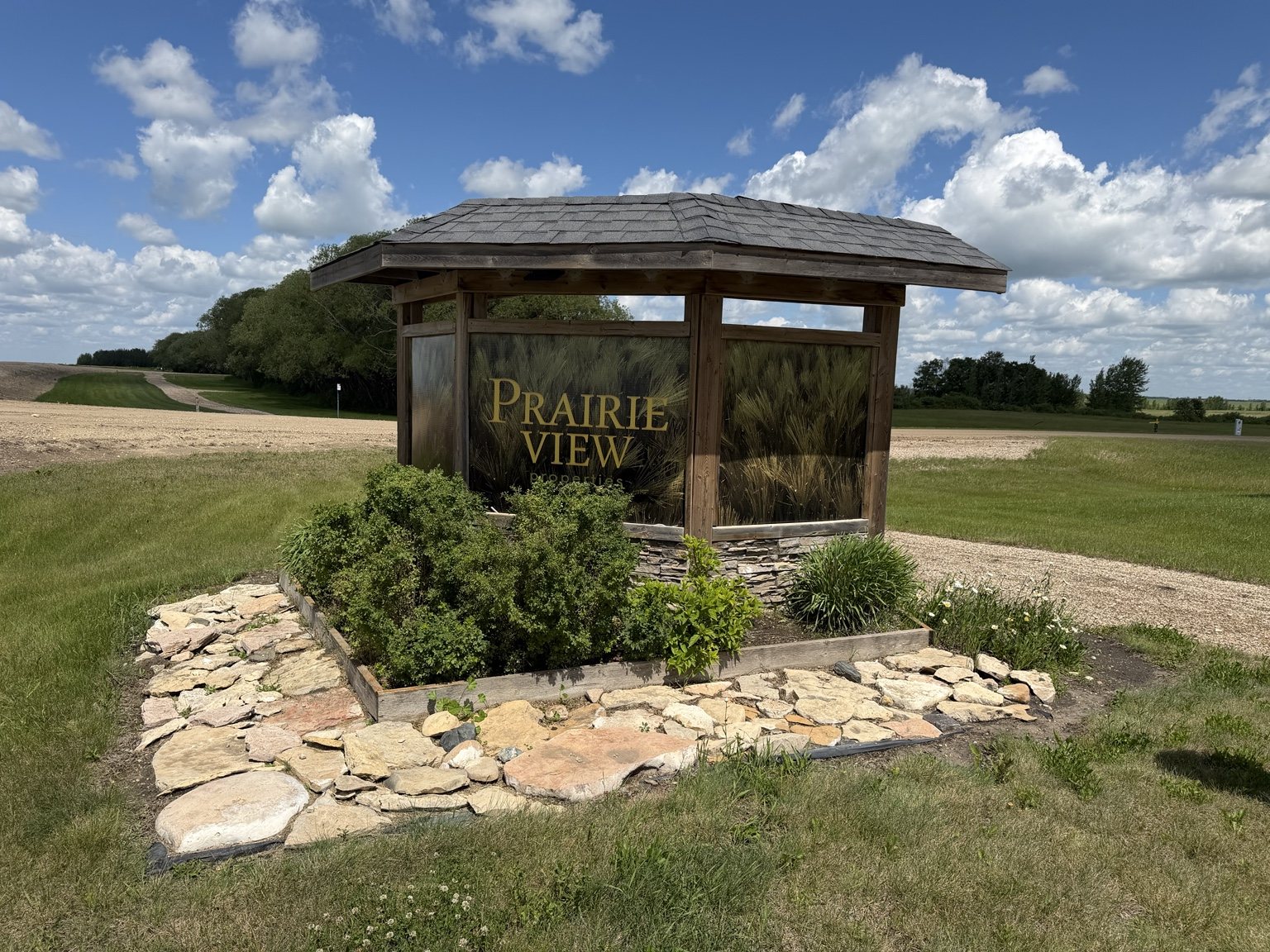
Prairie View trailhead and neighbourhood development sign outside Humboldt

Outside town, we found Prairie View Trail, a 2.4-kilometre loop near a newer residential development.

It was a perfectly pleasant local walking path, but it was not quite the destination trail experience I had imagined going into the day.

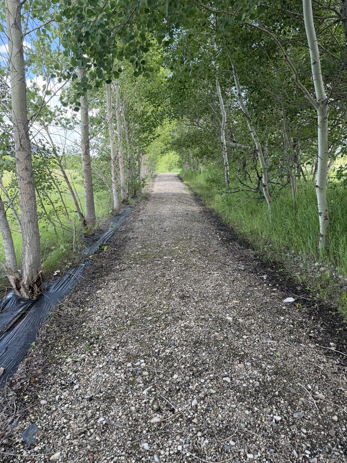
Wide gravel trail bordered by grass and trees at Prairie View

The route followed a wide gravel path through open prairie and trees, with portions running behind residential properties. It had a very neighbourhood-walking-loop energy.

We wandered for a while, and once again I reached the point where I was thinking, “we should probably turn around soon.”

Once again, a giant puddle appeared and made the decision for me.

At this point Saskatchewan trail conditions were becoming my personal trip coordinator.

Water Ridge Park: Okay, This Is More Like It

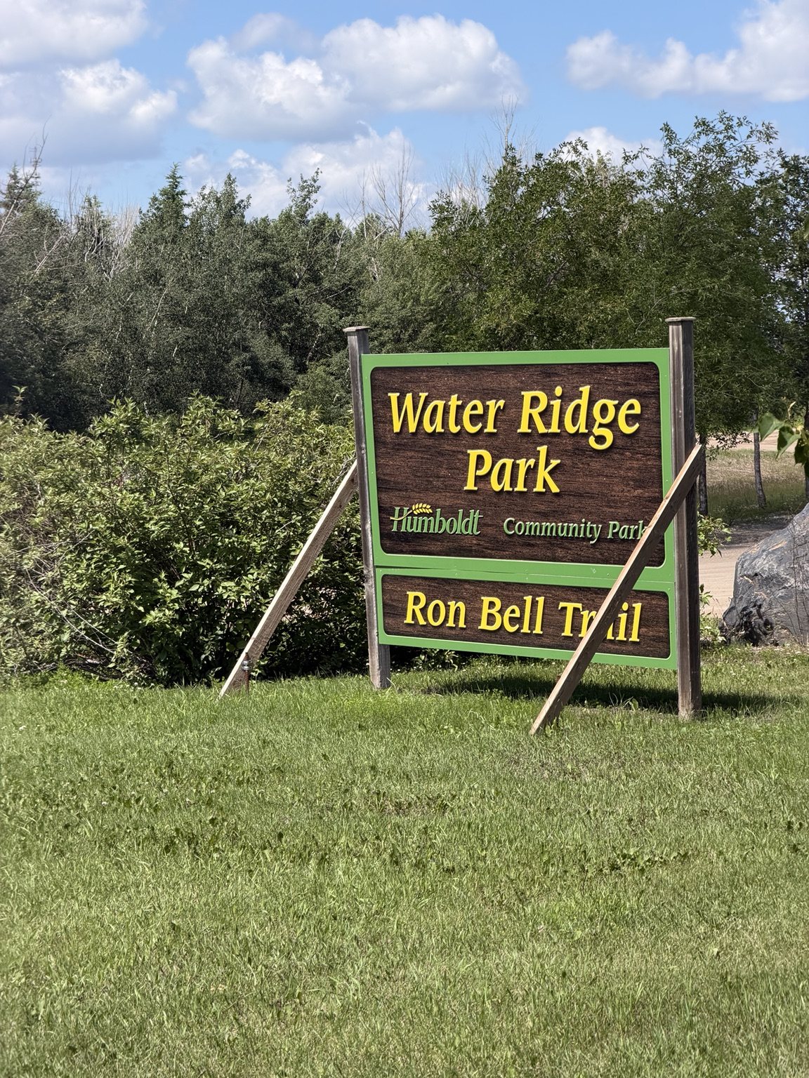
Eventually we found Water Ridge Park and the Ron Bell Trail near the golf course and spray park.

Water Ridge Park and Ron Bell Trail sign in Humboldt

This was a much more extensive park trail experience, with wetlands, open paths, shaded sections, little bridges and Ducks Unlimited interpretation.

Walking trail beside wetlands at Water Ridge Park
The trail mission finally starts making sense.

There were also pages from a children’s Christmas story posted along parts of the route, which had strong StoryWalk energy and raised several questions in July.

I support keeping the holiday spirit alive, apparently.

The City of Humboldt says it has more than 30 acres of parks and open spaces and a growing community trail system, and by this point in the day we were definitely seeing that broader network rather than one single destination hike.

We considered stopping at Original Humboldt on the drive back. It would have added more historical interpretation and another walking opportunity.

My energy levels said no ❤️.

Original Humboldt will have to wait for another trip.

Before You Go

  • Humboldt works well as a day of smaller walking experiences rather than one giant hike.
  • Do not skip downtown if you like public art and local history.
  • Prairie View is more of a community walking loop than a wilderness trail.
  • Water Ridge Park gave us the most varied trail experience of the day.
  • Leave room for lunch. Grandma cannot be expected to run a travelling catering operation forever.

Ella-vated Trail Rating

Category Rating Notes
Public Art Surprise 10/10 Came looking for trails. Accidentally got a downtown art walk.
Heritage Garden Charm 9.5/10 Flowers, murals, painted rocks, and Roksy. Tiny civic-space overachiever.
Likelihood of Knowing Whether You’re on the Intended Trail 2/10 We found a trail. Was it the trail? Spiritually, maybe.
Prairie View Vibes 6.5/10 Pleasant local walking loop, but definitely more “behind the neighbourhood” than wilderness adventure.
Puddle Turnaround Assistance 10/10 Once again, nature kindly handled the decision-making.
Water Ridge Redemption 9/10 Wetlands, bridges, shade, more trail variety, much closer to what we were actually hoping to find.
Lunch Reward 10/10 Grandma was officially off packed-lunch duty and Johnny’s understood the assignment.
Energy Remaining for Old Humboldt 0/10 Beautiful theoretical possibility. Absolutely not. ❤️
Final Ella-vated Rating 8/10 A slightly confusing trail mission that turned into a genuinely fun day of art, food, local paths and accidental discoveries.

Humboldt was not the cleanest trail assignment of the trip, but it might have been one of the best examples of why wandering around a community can be worthwhile.

We went looking for a trail.

We found murals, mosaics, a rock snake, lunch, two different walking areas, wetlands and exactly enough adventure for one very hot day.

This article is part of the SaskTrails Storyteller Series. Thank you to the Saskatchewan Parks and Recreation Association and Trans Canada Trail for supporting this initiative.

Ella Gidluck is the Saskatchewan Trails Association’s 2026 Summer Storyteller. She’s on a mission to prove Saskatchewan trails are cooler than people think, even when the mosquitoes disagree.
Finlayson Island trail map sign standing in floodwater

When the Trail Has Other Plans: Exploring the Battlefords

ELLA-VATED TRAILS

Exploring Saskatchewan trails through storytelling, small adventures, and occasional navigational failure.

By Ella Gidluck, SaskTrails Storyteller

When the Trail Has Other Plans: Exploring the Battlefords

Some trail days go exactly as planned.

This was not one of them.

My grandma joined me for a day of exploring the Battlefords, with Finlayson Island at the top of our list. The area is normally part of a much larger river-valley trail network. The Town of Battleford says the south side of the North Saskatchewan River has more than 19 kilometres of paved and grass trails, with another 12.5 kilometres of grass nature paths on Finlayson Island.

Great.

Except when we arrived, a significant portion of Finlayson Island was underwater.

Even the trail map was standing in floodwater.

Plan A: Absolutely Not

There would be no Finlayson Island hike that day, so we did the logical thing and walked across the nearby bridge instead.

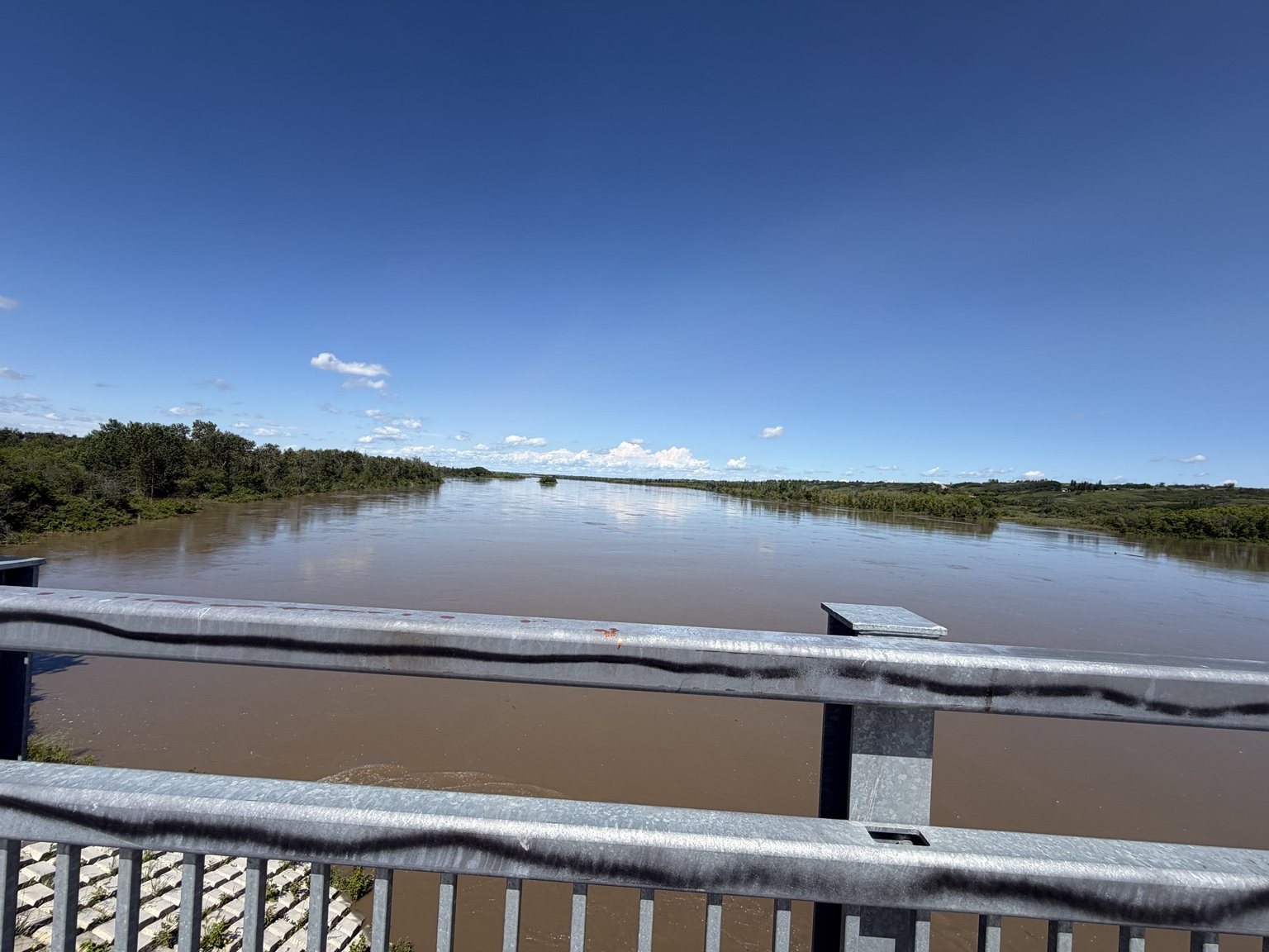
High water in the North Saskatchewan River viewed from the bridge
The North Saskatchewan River was making a very strong case for staying on the bridge.

From above, we could really see how high the water was and how far it had pushed into the low-lying parts of the river valley.

There was also a lot of graffiti on the bridge, because apparently no Saskatchewan bridge is allowed to remain spiritually untouched.

Plan B: South Shore Trail

Our next attempt started near the Fred Light Museum.

South Shore Trail sign overlooking the Battlefords river valley

The section we explored dropped steeply from the museum area on a gravelly path before entering a much more wooded landscape. It was one of those descents where the downhill part feels great until you remember you eventually have to come back.

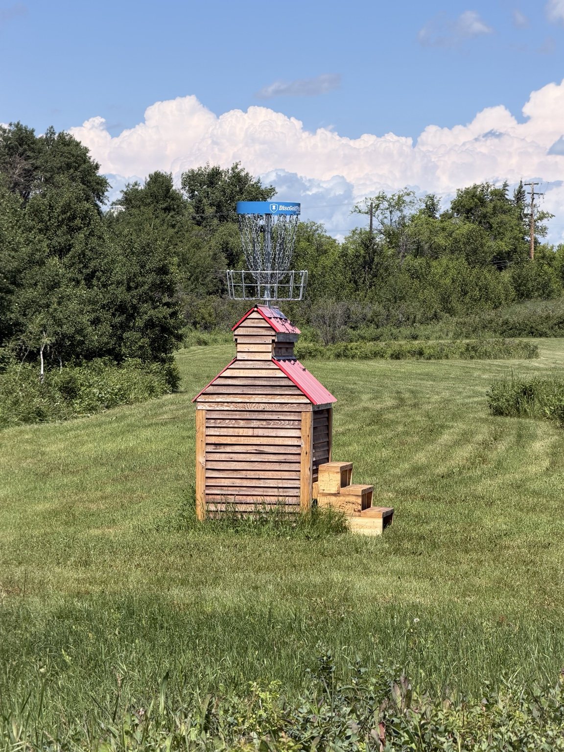
The trail also passes through a disc golf course, which gave us one of my favourite random discoveries of the day.

Disc golf basket mounted on a small grain-elevator-style structure
Saskatchewan found some elevation and immediately got creative with it.

One of the baskets was mounted on a little grain-elevator-style structure. We do not get a ton of disc golf courses with dramatic elevation in Saskatchewan, so seeing the hillside incorporated into the course was genuinely fun.

We kept going, crossed a busy roadway and reached another trailhead.

Flooded.

The timing was almost considerate. I had just told my grandma that if we wanted enough energy to get back up the hill, we should probably turn around soon.

The trail made the decision for us.

What Goes Down Must Eventually Climb Back Up

The return climb was steep enough that stopping for too long felt like I might simply roll backward.

Grandma and I handled it in sections. We would pick a rock or tree ahead, make it there, stop for a breather, then choose the next landmark.

My grandma is a champ, but I would not describe that particular section as especially senior-friendly. Loose gravel and a serious grade can make a short distance feel much longer.

My calves had opinions.

A Very Earned Lunch Break

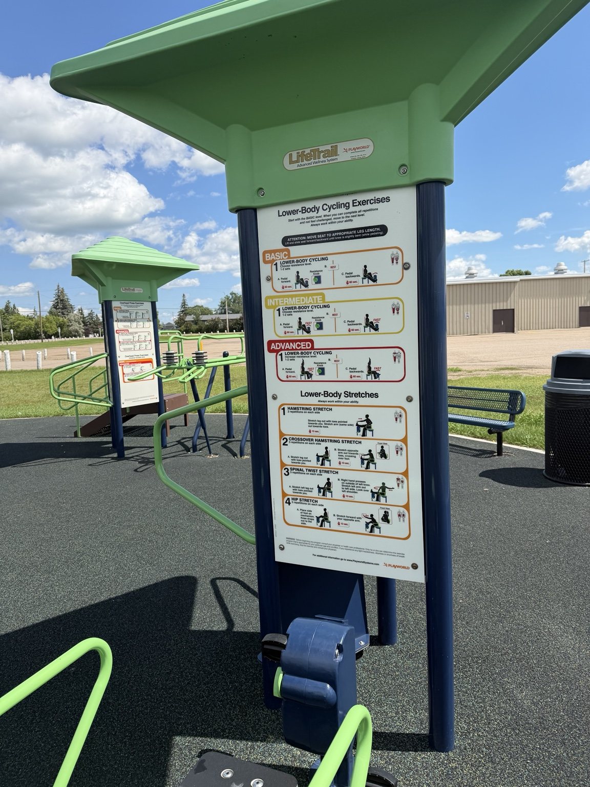
Outdoor LifeTrail fitness equipment designed for adults 50 and older

After surviving the climb, we found a nearby park with something neither of us had seen before: outdoor LifeTrail fitness equipment designed for adults 50 and older.

Obviously we had to try it.

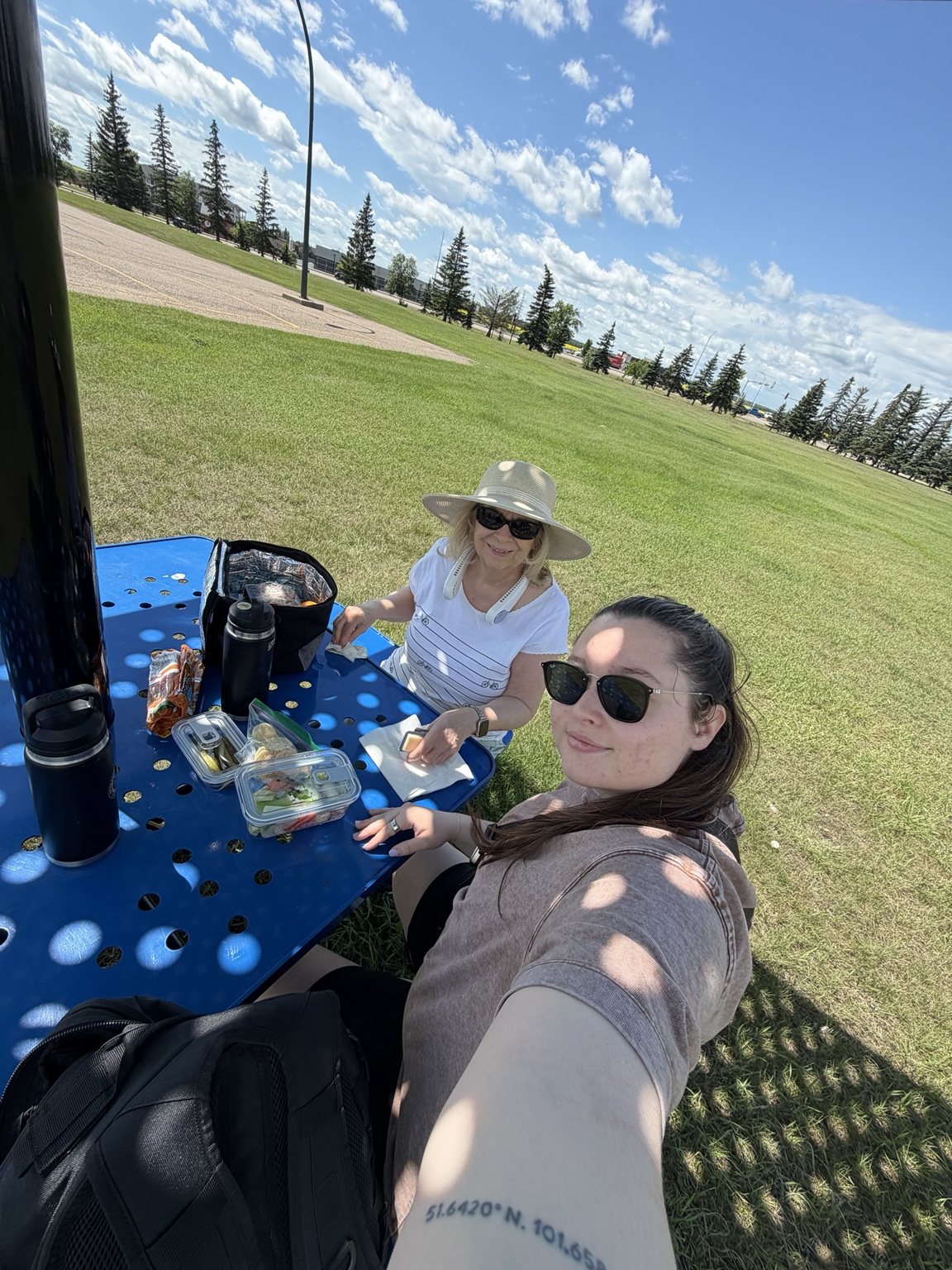
Grandmother and granddaughter eating lunch at the outdoor fitness park
Grandma packed lunch again. Morale restored.

We ate lunch in the shade while groups of people biked through the park toward Tim Hortons. Then they would reappear later with Iced Capps in hand.

Apparently this was the move.

It was peaceful, very hot, and I eventually handed Grandma my neck fan because survival is a team sport.

Final Stop: King Hill Lookout

We finished the day at King Hill Lookout. After the South Shore climb, this was exactly the kind of final stop we needed.

Drive up, park, take a short walk, visit the viewing platforms, enjoy the payoff.

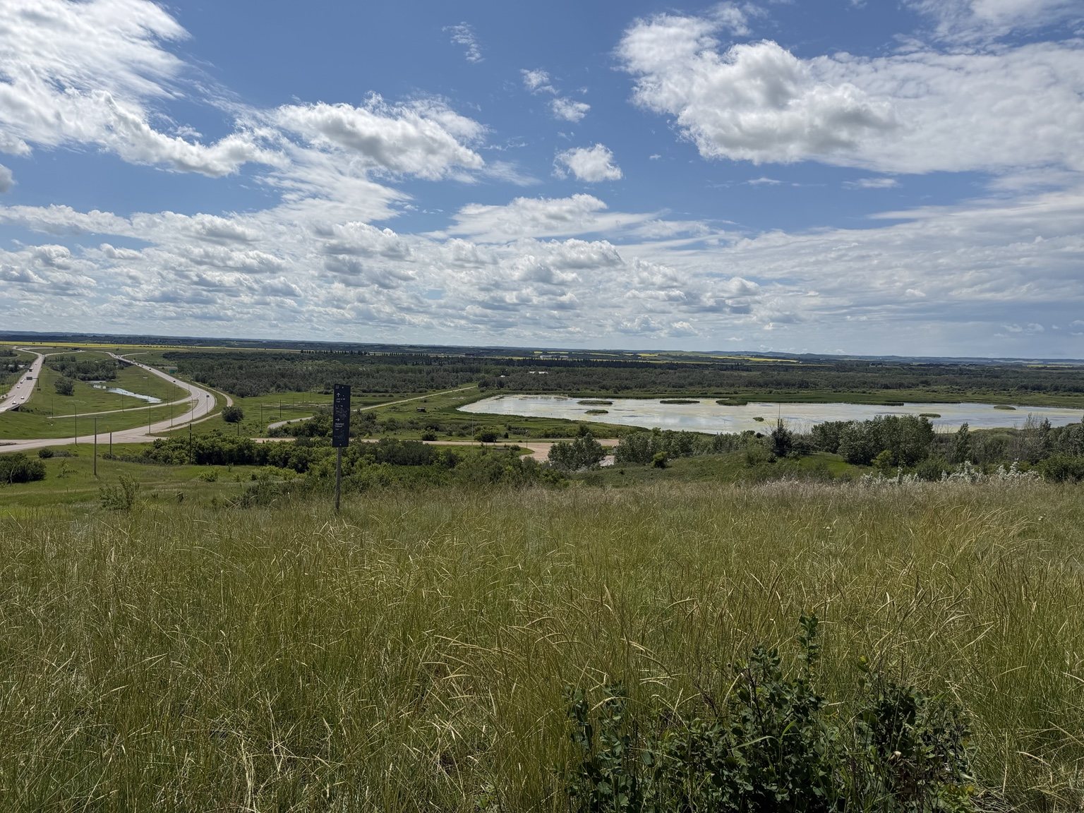
Wide view over the Battlefords river valley from King Hill Lookout
A much easier way to earn a giant river-valley view.

The platforms look out across the Battlefords and the North Saskatchewan River valley. After spending the morning seeing the high water from ground level, it was striking to finish the day above everything and look back across the landscape.

Before You Go

  • The Battlefords trail network is extensive, so you have options if one route does not work out.
  • Natural conditions can change access quickly, especially around the river.
  • The South Shore section we walked included a substantial climb back toward the Fred Light Museum.
  • King Hill Lookout is a great option if you want a big view without a long hike.
  • Apparently biking to Tim Hortons is a local recreational strategy worth considering.

Ella-vated Trail Rating

Category Rating Notes
River Valley Views 9/10 Beautiful, dramatic, and on this particular day, very wet.
Trail Predictability 3/10 We made plans. The river laughed.
Flooded Turnaround Timing 10/10 Every time I thought “we should probably turn back soon,” nature made the executive decision for us.
South Shore Calf Workout 12/10 Going down was fun. Coming back up was character development.
Senior Friendliness 5/10 Grandma handled it like a champ. Some of those grades absolutely would not be for everyone.
Disc Golf Creativity 10/10 Saskatchewan finally found some elevation and immediately put a basket on a grain elevator. Respect.
Picnic Recovery Potential 10/10 Shaded lunch, neck fan, people biking for Iced Capps. Peak civilization.
King Hill Payoff 9.5/10 Short walk, big view, exactly what tired legs needed.
Final Ella-vated Rating 8.5/10 Chaotic, scenic, unexpectedly fun, and proof that a failed trail plan can still make a very good day.

We did not complete the routes we had planned.

Instead, we walked a bridge, explored part of the river valley, found an excellent disc golf basket, climbed a hill that made our calves question our decisions, tested a seniors fitness park, ate another grandma-packed picnic and finished at a lookout above the valley.

Sometimes the trail trip is less about completing the route and more about seeing where the day takes you.

And sometimes the trail itself politely tells you when it is time to turn around.

This article is part of the SaskTrails Storyteller Series. Thank you to the Saskatchewan Parks and Recreation Association and Trans Canada Trail for supporting this initiative.

Ella Gidluck is the Saskatchewan Trails Association’s 2026 Summer Storyteller. She’s on a mission to prove Saskatchewan trails are cooler than people think, even when the mosquitoes disagree.
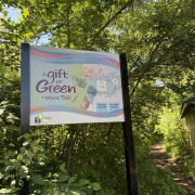
Gift of Green Nature Trail trailhead sign at Pike Lake Provincial Park

A Lot of Landscape in 1.5 Kilometres: Exploring Pike Lake

ELLA-VATED TRAILS

Exploring Saskatchewan trails through storytelling, small adventures, and occasional navigational failure.

By Ella Gidluck, SaskTrails Storyteller

A Lot of Landscape in 1.5 Kilometres: Exploring Pike Lake

Pike Lake Provincial Park was one of the stops I was most excited to explore during my Saskatoon-area trip, and this time I had company.

My grandma joined me for the day, which made the visit feel a little less like a work assignment and a lot more like a summer outing.

We parked near the main beach area and headed toward the Gift of Green Nature Trail. Tourism Saskatchewan describes the Gift of Green as a 1.5-kilometre loop through aspen trees, short-grass prairie and sand dunes.

That sounds like a lot to fit into 1.5 kilometres.

It is.

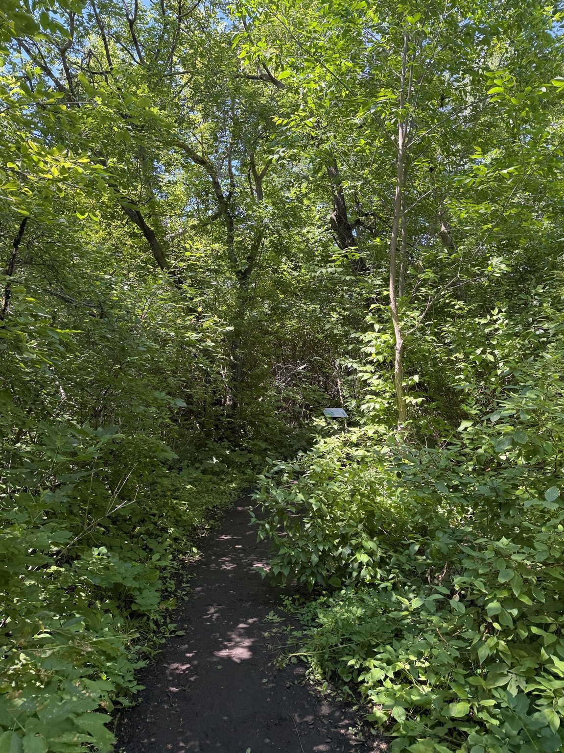
Shaded wooded section of the Gift of Green Nature Trail
The trail starts off feeling very forested. This does not last.

Forest, Wetland, Sand Dunes, Repeat

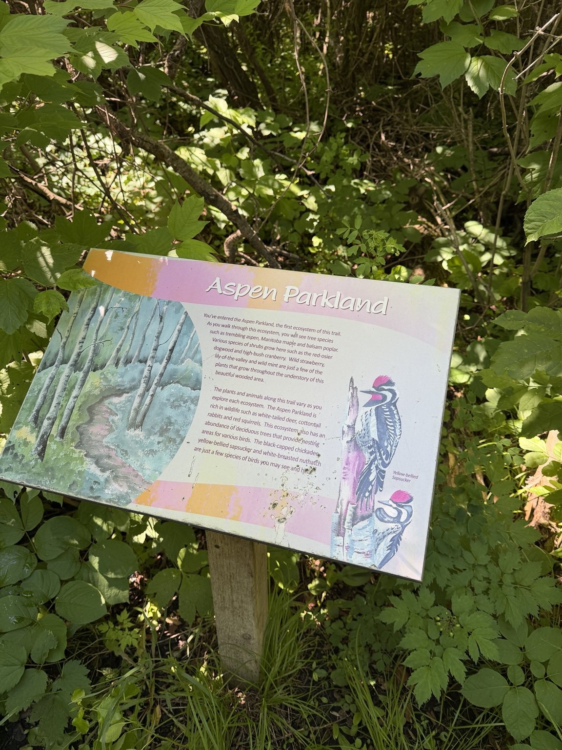
The trail begins under a thick canopy in the Aspen Parkland. It felt shaded, leafy and almost enclosed, especially compared with the open prairie most people picture when they think of southern Saskatchewan.

Aspen Parkland interpretive sign on the Gift of Green Nature Trail

Then the landscape starts changing quickly.

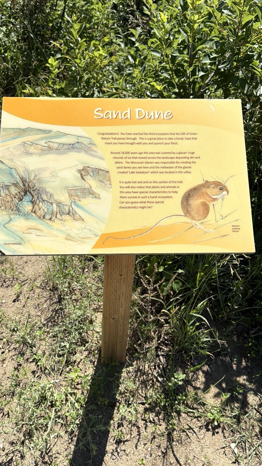
We moved through muddy patches, grass, gravel, boardwalk and wetter vegetation before suddenly reaching sections that felt almost desert-like. On a day above 30°C, the difference between the shaded woods and exposed sandy areas was not subtle.

Sand Dune interpretive sign explaining the glacial landscape at Pike Lake
The trail really said: what if we changed ecosystems again?

The interpretive signs are one of the best parts of the trail. They explain the different ecosystems, plants, wildlife and glacial history of the area as you move through it.

My grandma and I read all of them.

We are not capable of casual educational signage. If information has been mounted to a post, we will be stopping.

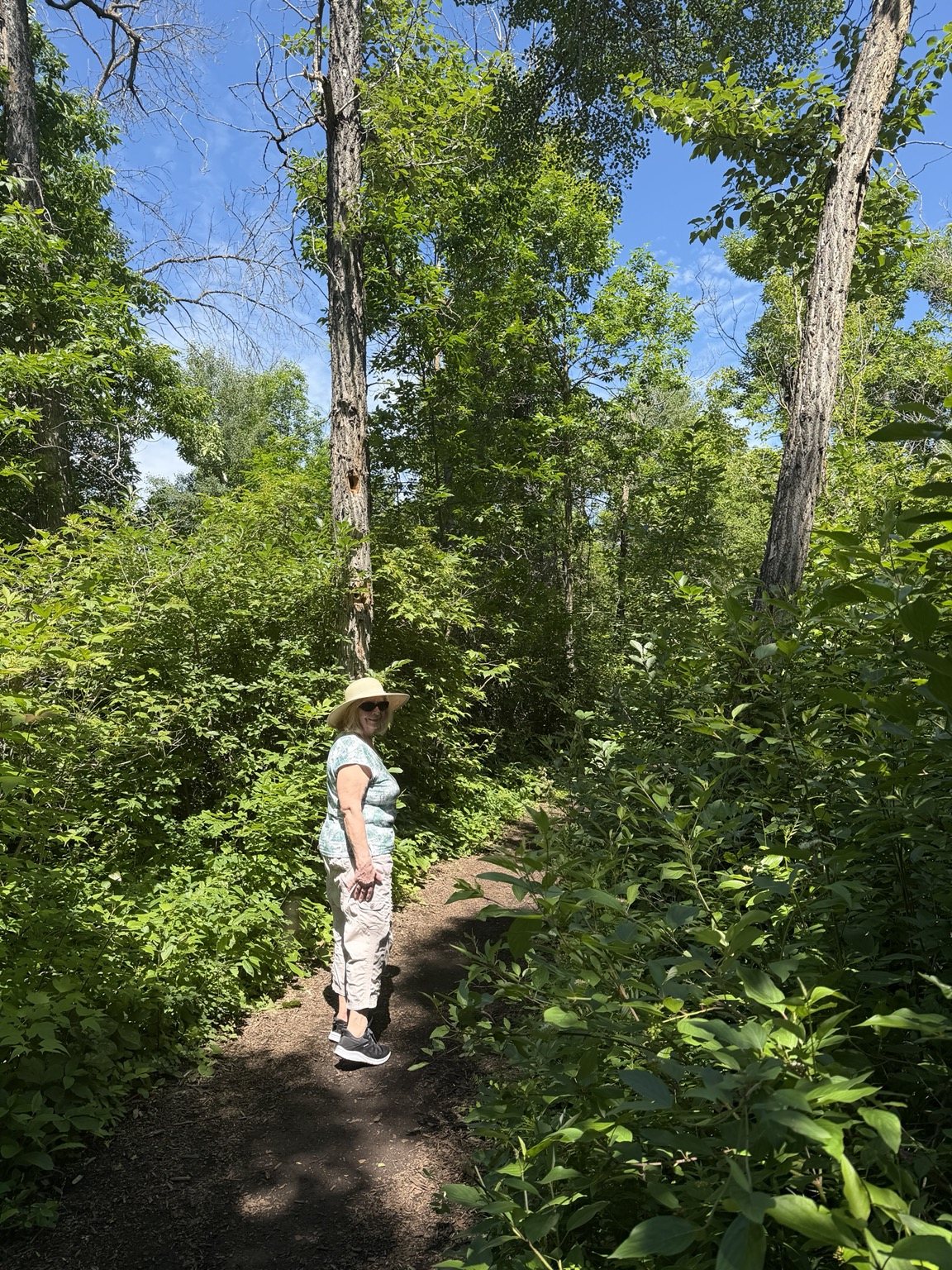
Grandmother walking on the wooded Gift of Green Nature Trail
Grandma, absolutely crushing the Gift of Green Nature Trail.

We saw birds, squirrels and, naturally, plenty of insects along the way. The trail was generally in good shape during our visit, but its short distance does not necessarily mean it will work for everyone.

There were natural and uneven surfaces, muddy sections and sand. My grandma pointed out that some of her senior friends would not have the mobility to complete it comfortably. She handled it like a champ, but the terrain is worth keeping in mind.

Lake Time and a Grandma-Packed Picnic

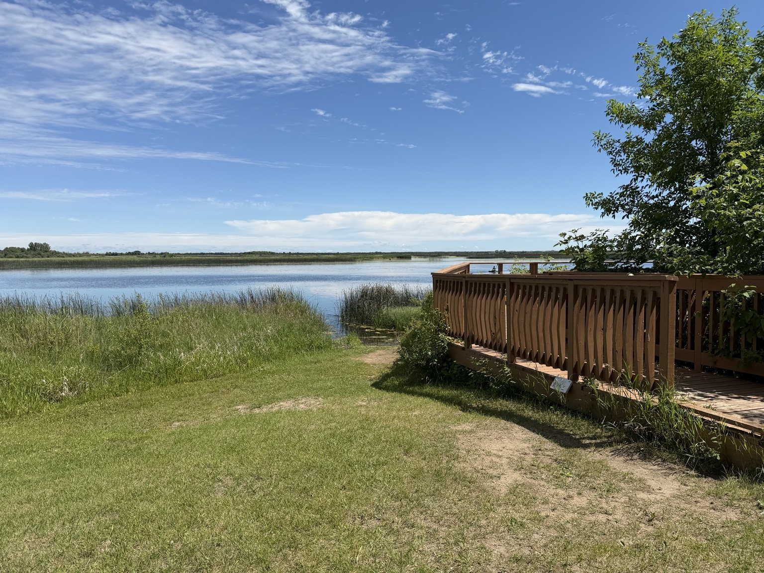
Pike Lake shoreline and wooden viewing deck under a bright summer sky

After finishing the trail, we drove around the park to look at some of the cabins, beach areas and places where we could eat lunch.

My grandma had packed us lunch, so we eventually found a shaded picnic area and settled in.

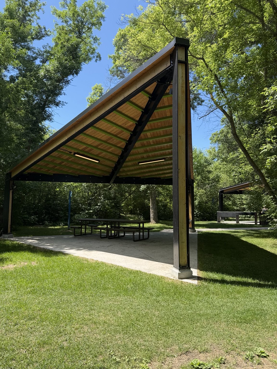
Shaded picnic shelter at Pike Lake Provincial Park
A shaded picnic spot becomes premium real estate above 30°C.

Thankfully, my grandma also does not believe in under-applying sunscreen. I was protected whether I liked it or not.

The park was busy throughout the day, which was not surprising for a hot Saturday. What did surprise us was the lineup on the way out.

It was absurd.

Vehicle after vehicle was waiting to enter the park. If you are planning a summer weekend visit, arriving earlier in the day would be one of my biggest recommendations.

On our way back toward Warman, we also stopped at Solar Gardens to check out the succulent farm, which was a fun little bonus stop and a very cute way to finish the day.

Before You Go

  • The Gift of Green Nature Trail is short, but the terrain is more varied than the distance suggests.
  • Expect a mix of natural surfaces including sand, mud, gravel, grass and boardwalk.
  • Give yourself time to read the interpretive signs. They make the trail much more interesting.
  • On busy summer weekends, go earlier if you can.
  • Bring sunscreen, or bring my grandma.

Ella-vated Trail Rating

Category Rating Notes
Ecosystem Variety 10/10 Forest, wetland, sand, mud, boardwalk. Pick a biome.
Interpretive Signage 10/10 Grandma and I read every single sign because apparently we are incapable of casual museum behaviour.
Trail Surface Variety 9/10 Grass, sand, mud, gravel, boardwalk. Keeps your ankles guessing.
Senior Friendliness 6.5/10 Grandma crushed it, but she was clear that some of her friends would not enjoy the terrain.
Picnic Potential 10/10 Grandma-packed lunch under shade. Elite.
Saturday Crowd Level 11/10 The lineup to get into the park when we left was unhinged. Go early.
Sunscreen Enforcement 12/10 Grandma does not mess around.
Final Ella-vated Rating 9/10 Pretty, educational, varied, and absolutely worth doing if you beat the weekend rush.

For such a short trail, the Gift of Green packs in a surprising amount. You can go from dense shade to sandy, exposed terrain and back again before lunch.

And if your grandma packs the lunch, even better.

This article is part of the SaskTrails Storyteller Series. Thank you to the Saskatchewan Parks and Recreation Association and Trans Canada Trail for supporting this initiative.

Ella Gidluck is the Saskatchewan Trails Association’s 2026 Summer Storyteller. She’s on a mission to prove Saskatchewan trails are cooler than people think, even when the mosquitoes disagree.
Blackstrap Provincial Park entrance sign with Blackstrap Lake in the background

Blackstrap Provincial Park: Surely It Levels Out Around the Next Corner

ELLA-VATED TRAILS

Exploring Saskatchewan trails through storytelling, small adventures, and occasional navigational failure.

By Ella Gidluck, SaskTrails Storyteller

Blackstrap: Surely It Levels Out Around the Next Corner

Just a short drive south of Saskatoon, Blackstrap Provincial Park combines lake views, rolling terrain and a trail network that is considerably hillier than Saskatchewan stereotypes would suggest.

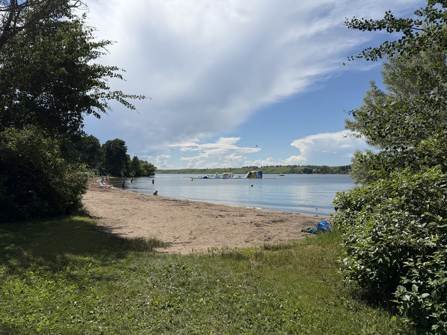
I started my visit by stopping at the park office for my park pass, then spent some time wandering around the shoreline and day-use areas. Blackstrap Lake was calm, the beach was busy enough to feel summery without being overwhelming, and there were plenty of places to stop for a view before I committed myself to the actual hiking portion of the day.

Sandy beach and calm water at Blackstrap Lake
A calm start before the mosquitoes learned I had arrived.

Tourism Saskatchewan lists 15 kilometres of trails at Blackstrap, used by hikers, mountain bikers and cross-country skiers. The park itself sits among rolling hills and coulees, which becomes very obvious the second you leave the shoreline and start walking uphill.

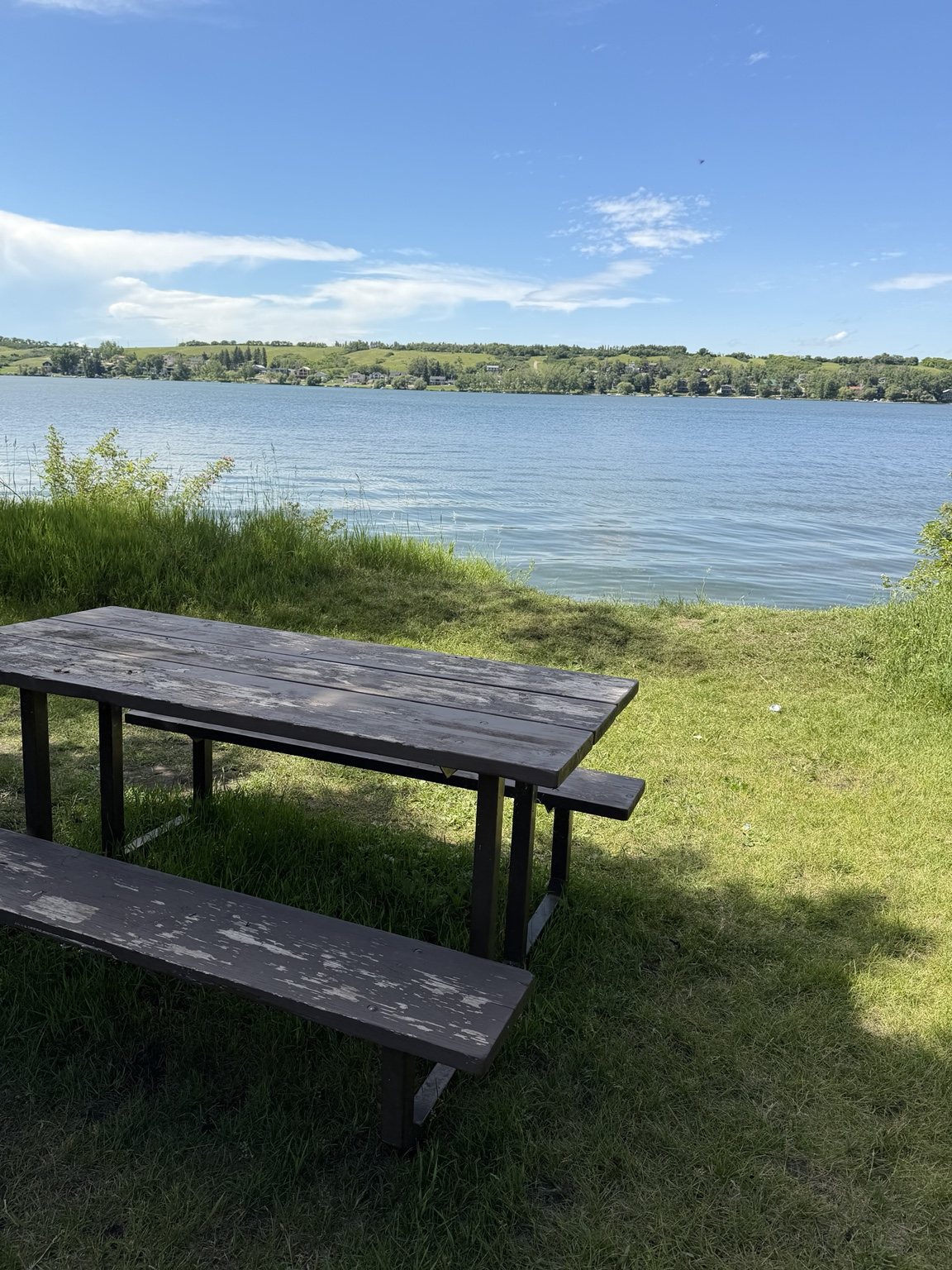
Picnic table overlooking Blackstrap Lake

Okay, Time to Hike

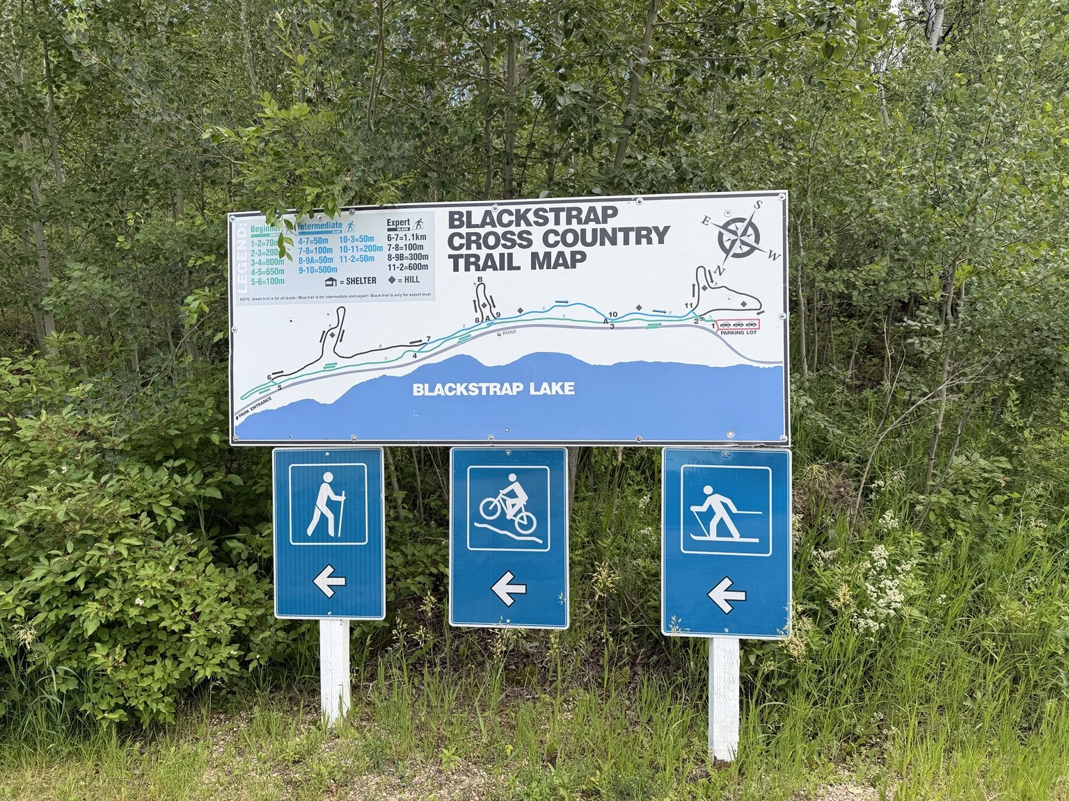
I eventually headed over to the cross-country trail system, where a large map lays out a network of beginner, intermediate and expert routes.

Blackstrap cross-country trail map showing beginner, intermediate and expert routes
In hindsight, I should have studied this for longer than approximately four seconds.

The route I ended up on started steep and grassy, surrounded by thick summer vegetation. I wish I could tell you exactly which trail I followed.

I cannot.

The network branches pretty quickly, and between the mosquitoes and my confidence that I would simply figure it out as I went, I never quite established which named route I was actually on.

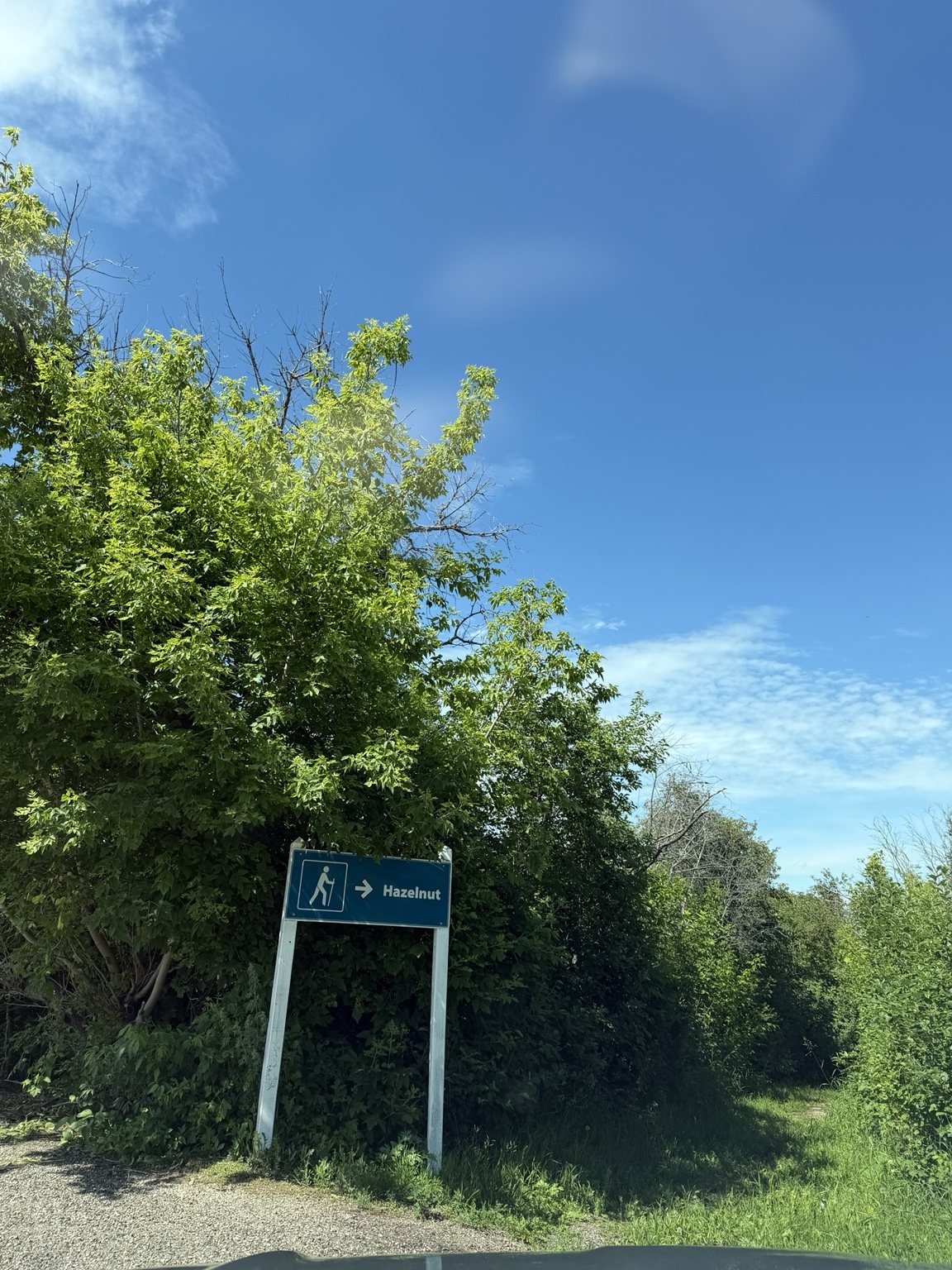
Hazelnut trail sign at Blackstrap Provincial Park beside dense summer vegetation

The trail kept climbing. Every time I rounded a bend, I told myself there was probably a flatter section or lookout just ahead.

There was not.

It was more uphill grass enclosed by trees.

The Mosquitoes Win This Round

About ten minutes in, I accepted that I did not currently possess the strength, patience or blood volume required to continue battling the mosquito population.

A thunderstorm was also rolling in, which provided a very dignified reason to turn around and pretend this decision was entirely weather-related.

One practical thing I noticed at Blackstrap was the limited cell service. If you are relying on a trail map, directions or anything else on your phone, downloading it before you arrive would be smart.

Before You Go

  • Take a photo of the trail map before starting.
  • Bring bug spray during mosquito season. Then perhaps bring more bug spray.
  • Expect some real elevation by Saskatchewan standards.
  • Do not count on reliable cell service throughout the park.
  • Leave some time for the shoreline and day-use areas, even if your hike is shorter than planned.

Ella-vated Trail Rating

Category Rating Notes
Lakeside Views 9/10 Very pretty before the mosquitoes declared war.
Initial Incline calves noticed The trail simply kept going up.
Trail Wayfinding 5/10 I was technically on a trail. Which one? Great question.
Mosquito Commitment 14/10 They wanted me more than I wanted the hike.
Cell Service thoughts and prayers Download anything you need before arriving, including your tunes.
Thunderstorm Timing 10/10 Excellent excuse to accept defeat with dignity.
Final Ella-vated Rating 7.5/10 Beautiful park. Trail rematch pending stronger bug spray.

Blackstrap did not give me the longest hike of the trip, but it gave me lake views, a decent calf workout, a mystery route and a very clear reminder that Saskatchewan mosquitoes are capable of ending negotiations.

I would go back.

I would just arrive with significantly more insect repellent.

This article is part of the SaskTrails Storyteller Series. Thank you to the Saskatchewan Parks and Recreation Association and Trans Canada Trail for supporting this initiative.

Ella Gidluck is the Saskatchewan Trails Association’s 2026 Summer Storyteller. She’s on a mission to prove Saskatchewan trails are cooler than people think, even when the mosquitoes disagree.