Blue and white "Welcome to Duck Mountain Provincial Park" sign with a stone pillar base, surrounded by green grass and yellow autumn trees.

Madge Moments: My Trail Start at Duck Mountain

ELLA-VATED TRAILS

Tracing prairie trails through memory, discovery, and home.

By Ella Gidluck, SaskTrails Storyteller


Duck Mountain isn’t new to me.

I’ve spent summers at Madge Lake for as long as I can remember. It’s where my family has a cabin, where we roast marshmallows, take the dogs for long walks, and jump into the lake even when the water feels ridiculously cold. I even worked at Friends of Madge Lake for a summer when I was 16, at the Treats & Treasures store by Ministick Beach. I know this place and its community. It’s part of who I am.

But this summer, I came back with a different purpose, and suddenly, everything looked a little different.

Instead of just visiting, I was here to see. To listen. To learn. I started my trip with a stop at Duck Mountain Lodge: a cozy, red-trimmed building tucked into the trees, with a bright blue sign that makes it impossible to miss. It ended up being one of the best decisions I could have made.

Front of Duck Mountain Lodge featuring large blue and brown wooden sign under a bright blue sky.

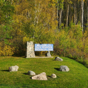
The iconic turquoise sign that welcomes visitors to Duck Mountain Lodge.

Duck Mountain Lodge, the perfect starting point for my trail storytelling trip.

A Lodge with Heart

The lodge sits right in the woods, tucked away but easy to find if you know where to look. I met April, one of the co-owners, who reopened the space with her partner Jordan in May 2023. From the moment we started talking, I could feel how much she loves this place, not just the lodge, but the park, the trails, and the people who show up year after year.

“Life is so hectic,” she said. “And when you’re out here, it’s just, *she takes a deep breath*… You can breathe.”

I knew exactly what she meant. Just stepping out of the car that morning felt like hitting reset.

April moved from Regina to Kamsack years ago, but Duck Mountain has always been her escape. She talked about frog hunting in creeks as a kid, the kind of childhood joy that sticks with you. Now, she’s building that kind of joy for other people through good food, warm beds, and real conversations.

We chatted in the new café space, where fresh-baked treats sat behind glass and a chalkboard menu hung above the espresso machine. It’s modern and welcoming, with plants tucked between pastries and signs that say things like “Good Vibes Only.” A soft launch now, but it’s clearly becoming something special.

Café counter at Duck Mountain Lodge with drink fridge, dessert case, and welcome signs under hanging lights.

Duck Mountain Lodge’s cozy café offers coffee, baking, and good vibes only.

The lodge café serves up smoothies, cinnamon buns, and good vibes.

Most of their visitors are from Manitoba, though more people from Saskatchewan are starting to catch on. She laughed about the number of folks who just stumble across the lodge while walking to the beach. This year feels like their first real summer. People are finally discovering them, and they are ready to welcome them with open arms.

April and I snapped a quick photo in front of the lodge before she darted back to the kitchen. It’s rare to meet someone who’s as passionate about people as she is about good food.

April, co-owner of Duck Mountain Lodge, sitting with Ella inside the lodge dining area with ketchup, salt and pepper on the table in front.

April and I after a great chat about trails, food, and finding peace in the woods.

Trail Wisdom

When I asked April about her favourite hikes, she lit up. Her go-to is a loop that starts from the Batka Lake parking lot and winds past Moose Lake, Jackrabbit Shelter, and the ski hill. It’s a solid workout with birdsong for background music and plenty of spots to stop, rest, and breathe.

“It’s like meditation,” she told me. “You just close your eyes and listen.”

That phrase stuck with me. Later in the week, I walked part of that route and thought about what she’d said. The trails I’ve known forever felt unfamiliar in the best way. Like I was being introduced to them for the first time, not by a map, but by someone who truly knows them.

One trail was lined with ferns – waist-high, bright green, and practically glowing in the sun. I’d never noticed them before, not like that. Maybe I just hadn’t slowed down long enough to look.

Dense green fern field surrounded by trees under midday light near Madge Lake.

A lush carpet of ferns just off the trail at Madge Lake.

More Than Just a Meal

Back at the lodge, April’s menu reflects her background as a certified health coach. She does it all: burgers, salads, vegan meals, gluten-free everything, even custom dishes for guests with dietary needs. She’s not just making food. She’s fuelling people, especially those who want to stay active while they’re here.

“I don’t penny-pinch,” she said. “I’m using the real good cheese. It’s not about making money. It’s about people leaving here saying, ‘This is the best plate I ever had.’ That means more to me.”

She also shared her own story of going gluten-free during her training and how it completely changed how she felt, even though she didn’t realize gluten had been affecting her in the first place. That kind of lived experience shows in the way she talks to guests. She’s not just handing out menus. She’s giving people options they didn’t know they needed.

I took my sister, Finlee, to the Lodge for lunch, we ordered pasta… and judging by her double thumbs-up, it was a hit. There’s something lovely about a place that feels this good and feeds you well.

Smiling young woman giving thumbs up behind a plate of cheesy spaghetti with a breadstick at Duck Mountain Lodge.

Finlee gives the spaghetti at Duck Mountain Lodge two thumbs up.

Finlee approved: hearty pasta and happy hikers welcome.

Coming Soon: Coffee and Cinnamon Buns

As if the lodge wasn’t already full of personality, April is now opening a specialty café with homemade donuts, smoothies, cinnamon buns, and milkshakes. I got a sneak peek of the milkshake cookbook. Yes, it includes a Fruity Pebbles one. Yes, I will be back.

She’s easing into it slowly, with more homemade items rolling out as she gains strength and rhythm. Her goal is to offer something good. Not just good enough. Good enough to remember.

Lasting Impressions

Before I left, I asked April how she’d finish this sentence:
“You haven’t truly experienced Duck Mountain until…”

“Until you’ve been here,” she said. “Like really been here. You can’t explain it. You have to feel it.”

I think she’s right.

On one of our last nights, I wandered down to the dock. The clouds were thick, but the sun still found its way through. The lake was still. It felt like the park was quietly saying, “You’re right where you need to be.”

Sun shining through clouds over a calm lake surrounded by trees and tall reeds.

Sun reflections over the water near the dock at Madge Lake.

End of day at Madge, where the trails wind down and the reflections start.

This first part of my Madge Lake journey reminded me that familiarity doesn’t mean you’ve seen it all. There’s always another story tucked between the trees, another voice to listen to, another trail waiting to surprise you.

Woman reading a brochure while sitting in a model boat at the Duck Mountain Provincial Park visitor center with educational displays behind her.

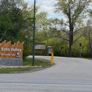
Getting to know the local trails at the Duck Mountain park office.

Next up, I take on the Fen Trail, visit Batka Lake Lookout, and learn what happens when you accidentally step off the boardwalk in the name of curiosity. Spoiler: it’s spongy.


This article is part of the SaskTrails Storyteller Series. Thank you to the Saskatchewan Parks and Recreation Association and Trans Canada Trail for supporting this initiative.

Ella Gidluck is the Saskatchewan Trails Association’s 2025 Summer Storyteller. She’s a university student with a love for quiet places, trail snacks, and telling the stories behind the paths we walk.

Entrance sign at Echo Valley Provincial Park surrounded by trees

Echo Valley – Built by Heart, History, and Hikers

ELLA-VATED TRAILS

Tracing prairie trails through memory, discovery, and home.

By Ella Gidluck, SaskTrails Storyteller


Until now, Echo Valley Provincial Park had always been somewhere I drove past, not into. I thought I was coming for a quick volunteer trail cleanup. I didn’t expect to walk away with a map, a few new trail names in my head (Badger, Owl, Raccoon) and a story about legacy, accessibility, and the quiet power of community.

This isn’t just a beautiful place to hike. It’s a place that’s been shaped by people who care.


“We all just pitch in.” – Rick, Trail Volunteer

Echo Valley trailhead sign with trail names

Trail names like Badger, Owl, and Raccoon greet you right from the start.

Rick met me in the parking lot, bright-eyed and fully geared up. He’s one of the folks behind the Echo Valley trail system as it exists today. He mapped routes with GPS (and a little help from the deer), organized cleanups, and added signage so you don’t get lost out there.

“We started from scratch. I just wanted a place to run, but I couldn’t maintain it all by myself… Now we’ve got over 1,000 people in the Facebook group.”

Rick, longtime volunteer at Echo Valley, standing on the trail

Rick, one of the original volunteers behind Echo’s current trail system.

He walked me through trail history like a local legend, pointing out how certain names came to be:

  • Badger Trail: “It’s the gnarliest one. Badgers are gnarly.”
  • Owl Trail: Named after the owl that swooped across the trees mid-run.
  • Rock Garden: A glacial bed of giant boulders you pass near the bottom of Badger Trail.

His favourite? “Definitely Badger. Down the hill, up through the bridges, past the glacier rocks. It’s got everything.”

Small wooden trail sign that reads 'Beware of Troll'

Echo Valley trail wisdom: come for the views, beware of trolls.

Rick also talked about how they’ve added “You Are Here” signs, color-coded markers, and community-friendly maps to help people explore safely. No app required. “We thought the techy people would scan the QR codes. Turns out, they just take pictures,” he laughed.


“This is your backyard.” – Shelly, Park Manager

Shelly, the park manager, talked to me about Echo’s bigger vision. It’s a legacy being built one trail and tree at a time. She told me how local school kids from Standing Buffalo, Pasqua First Nation, and Fort Qu’Appelle helped plant over 100 trees in the park last fall. They named them too — Leafy, Superman, Scotty (the Scots Pine). Elmer (the Elm), Sparkles.

“We want people to feel like this is theirs to protect, but also theirs to enjoy.”

Shelly shared Echo’s upcoming accessibility plans: a new all-persons trail close to the campground. Not paved, but solid-surfaced with minimal elevation changes, it’s built for walkers, wheelchair users, and anyone needing a more stable path.

“Right now, we don’t have a fully accessible trail. But we’re working on it.”

Framed photos from the 1980s Girl Guide Jamboree on display in the visitor centre

Framed slides from the 1980s Girl Guide Jamboree, still on display in the visitor centre.

Echo is also preserving its past, like a set of slides from the 1980s Girl Guide World Jamboree when over 3,500 Girl Guides camped right in the valley. One photo shows kids playing wheelchair volleyball — proof that Echo was thinking about accessibility long before it became a buzzword.


From Glacial Boulders to Girl Guides

Echo Valley is full of these unexpected stories. A trail system partly designed by following deer paths. A running race that doesn’t stop until everyone but one drops (yes, really — Rick calls it the “Backyard Ultra”). A park with one side reserved just for nature-based recreation to keep the valley wild for future generations.

“We’ve got people out here who care as much about the park as I do,” Shelly said. “That’s when cool things happen.”


If You Go

  • Start with Deer Trail if you’re new or bringing kids. It’s flat, shaded, and loops around with a great valley view.
  • Looking for a challenge? Try Badger Trail. You’ll find bridges, coolies, and the legendary Rock Garden.
  • Stop by the visitor centre and ask about the Girl Guide slides.
  • If you see a tree named Sparkles… give her a little wave.
Echo Valley trail with trees opening into a clear walking path

The kind of view that makes you slow down, breathe deep, and stay a little longer.


My Ella-vated Trail Ratings

5/5 Trees Named by Kids Who Totally Got It Right
Looking at you, Sparkles.

4.9/5 “You Are Here” Signs That Prevented a Panic Spiral
The other 0.1 is on me, not the map.

5/5 People Who Showed Up Because They Care
And somehow made trail cleanup feel like a party.

Echo Valley Provincial Park trail map showing all trail names and routes

Here’s your go-to trail map to start planning your Echo adventure. Don’t worry—they’ve added “You Are Here” signs too.


Read more trail stories and enter the 2025 Photo Contest at sasktrails.ca

This article is part of the SaskTrails Storyteller Series. Thank you to the Saskatchewan Parks and Recreation Association and Trans Canada Trail for supporting this initiative.

Ella Gidluck is the Saskatchewan Trails Association’s 2025 Summer Storyteller. She’s a university student with a love for quiet places, trail snacks, and telling the stories behind the paths we walk.

Saskatchewan Trails 2025 Annual General Meeting

Saskatchewan Trails 2025 Annual General Meeting

The 2025 Annual General Meeting will be held on Monday, April 14, 2025 via ZOOM at 7 p.m. The meeting coordinates are as follows:


Topic: STA Annual General Meeting

Time: Apr 14, 2025 07:00 PM Saskatchewan

Join Zoom Meeting

https://us02web.zoom.us/j/89443240440?pwd=PEIXvMRfph4fI4obiKbyt1Qmt34sGG.1


Meeting ID: 894 4324 0440

Passcode: 472535


The meeting will also feature an overview of the STA’s activities in 2025, audited financial statements and board elections.

Our Annual Report can be found STA-Annual-Report-2024.pdf

Our previous meeting minutes can be found here.

Our audited financial statements can be found here.


The AGM will also feature a presentation on the Wâhkôhtowin Trails. Dean Grove (Flin Flon Ski Club/Wâhkôhtowin Trails) will share insights on the region’s cross-country ski trails, the recent Saskatchewan Provincial Championships, and exciting plans to expand into adventure and trail biking. Shari Anderson will highlight the inspiring story of Wâhkôhtowin, a grassroots initiative where a small group of outdoor enthusiasts came together just a year ago and have already developed four all-season trails that serve a diverse community of trail users.


AGENDA

7:00 p.m.                               Welcome from the STA

Call to Order for Business Meeting

Approval of the Agenda

Approval of the Previous Meeting Minutes

Business Arising From the Minutes

President’s Report

Approval of Financial Statements

Approval of Auditor

Bylaw Amendments

Board of Directors Election

New Business


8:30 p.m. (approx.)           Adjournment

Capture the Magic: Saskatchewan Trails Association’s Winter Photo Contest 2025

Capture the Magic: Saskatchewan Trails Association’s Winter Photo Contest 2025

The chill in the air, the soft whisper of snowflakes, and the serene beauty of a winter wonderland — this season transforms Saskatchewan’s trails into a breathtaking canvas. As winter paints our favorite paths with its icy artistry, we are delighted to announce the return of the Saskatchewan Trails Association’s Winter Photo Contest!

This year, the contest will run from January 1 to January 31, 2025, offering a full month to explore and showcase the unique charm of Saskatchewan’s winter trails. Whether it’s the sparkle of frost-covered trees, the thrill of snowy adventures, or the quiet magic of a peaceful trail, we invite you to capture the essence of winter on our trails.

No matter your photography experience—whether you’re a seasoned professional or a casual enthusiast—this contest is open to everyone. It’s a chance to share your perspective, celebrate the beauty of Saskatchewan’s winter landscapes, and inspire others to embrace the outdoors during this enchanting season.

Get ready to bundle up, hit the trails, and let your creativity shine. We can’t wait to see the moments you capture!

This year, a fantastic set of prizes that await the winners of this contest. Our top prize winner will receive a prize package featuring:

  • Odoland Backpacking an Camping Cookware Set
  • Waterfly Waist Bag Fanny Pack with Water Bottle Holder
  • Snowtrek Collapsible Trekking Hiking Poles
  • Deesoo 20×52 Binoculars

Our first honourable mention will receive:

  • GT Bottles 18oz Stainless Steel Vacuum Insulated Wide Mouth Water Bottle
  • Sunland Outdoor Neck Gaiter
  • 2 Pack Hand Warmers, Rechargeable, Portable
  • Tudequ Hiking Waist Packs Fanny Pack with 2 Hidden Pockets

The second honourable mention will receive:

  • YETI- Rambler 20 oz Tumbler, Stainless Steel
  • Trekking Poles, Collapsible Hiking Poles
  • 6000mAh Battery Rechargeable Heated Socks
  • LED Flashlight, Ultra Bright XML, T6 Handheld

These prizes are to enhance your outdoor experiences and make your winter trail adventures even more memorable.

Participating in the Winter Photo Contest is easy. Simply take your camera or smartphone with you on your winter trail adventures and capture an activity – walking, snowshoeing, cross country skiing, snowmobile, and so on – that define this season on the trails. Share your photos on social media using the hashtag #winteronthetrailsphotocontest2025, and don’t forget to tag SaskTrails to ensure we see your submissions. For those without social media, please email us at info@sasktrails.ca.

All residents of Saskatchewan are eligible to enter the contest. STA board and staff members may submit photos, but they are not eligible to win. Photos may be submitted multiple times, but there is only one entry per photo. You may submit as many different photos as you would like. Please let us know where the photos were taken.

Check privacy settings to ensure that entries are visible, as private posts are not considered to be entered. Try and post photos in the highest resolution possible so that we can use them for potential printed materials. Winning photos may be used in Saskatchewan trails promotional materials through brochures, annual reports, social media and more. As pictures come in, they may be featured on our page, with credit to the photographer.

If you do not want to provide the Saskatchewan Trails Association (STA) permission to use your photos, please do not submit your photos.

By submitting photos, you confirm that (a) your photo is you own original work; (b) you own the rights to the photo, including copyright; (c) you have the right to give the STA permission to use your photo for the purposes specified in these rules; (d) the photo is not defamatory and does not infringe on any Canadian laws or violate the rights of any third party; (e) you have the consent of anyone who is identifiable in your photo or the consent of the parent or guardian of anyone who is a minor; (f) you waive any moral rights you might have in the photo; (g) you indemnify the STA against any claim, demand, action, suit, or other proceedings against the STA arising our of the use of the photo or any false or inaccurate statements. By entering, contestants agree to follow these contest rules, which shall be applied by the STA.

Winners, chosen the following week, will be announced on all of our pages and will be contacted to arrange to claim their prize. The deadline for submission is January 31, 2025, so make sure to have your photos in before then.

We encourage you to gear up, step outside, and let your camera capture the enchantment of winter on Saskatchewan’s trails. We can’t wait to see your photos and share in the beauty of this season with all of you. Good luck to all participants!

Step into a Country Pace: Lumsden Trail

Step into a Country Pace: Lumsden Trail

The town of Lumsden offers two unique opportunities for trail enthusiasts: The Lumsden/Deer valley section of the trans-Canada trail and the Lumsden walking tour.

Lumsden/Deer Valley Trail

The trail is approximately 16 km stretching from Lumsden River Park to Deer Valley. There are five information kiosks on the trail, each providing an overview of this section of the TCT including a detailed topographical map of the area where the kiosk is situated.

Walking, biking and hiking are suitable activities on the trail and canoeing/kayaking is a popular pursuit in the Qu’Appelle River and Wascana Creek. During the winter, walking within the town limits and cross-country skiing adjacent to the trail is possible; however, snowshoeing is the only suggested activity in the valley sections.

Lumsden Walking Tour

The Lumsden Walking Tour is a delightful way to explore the historical nooks and crannies of the town. The 6.5 km tour features quaint streets, old buildings, and a sense of nostalgia.

Here are some of the highlights:

  1. Historical Sites Galore: The tour boasts 51 historical sites and buildings scattered throughout Lumsden. You’ll feel like a time-traveling detective as you uncover hidden gems.
  2. Town Bell and Train Station: You’ll encounter the Town Bell, which probably rang out news of yesteryears, and the CNR Train Station is a vintage structure built in 1904.
  3. First Home Ever Built: Imagine standing where the very first home in Lumsden was constructed back in 1888.
  4. Living Skies Retreat Conference Centre: Originally known as St. Michael’s Retreat, it was established by the Franciscan Friars of Western Canada in 1963. Over the years, it has served as a venue for conferences, weddings, recovery and healing retreats, yoga and meditation sessions, and more.
  5. Lumsden Museum Heritage Park: This spot is like a scrapbook of Lumsden’s vibrant past. You’ll find displays, pictures, and various artifacts.

While you are in the area, there are a few other trails to note:

Lumsden to Craven Paddle 

Try this 18.7-km point-to-point trail near Lumsden. Generally considered a challenging route. This trail is great for birding and paddle sports, and it’s unlikely you’ll encounter many other people while exploring.

Hidden Valley Loop

Generally considered a moderately challenging route, this 1.6-km loop takes an average of 33 minutes to complete. This trail is great for hiking, and it’s unlikely you’ll encounter many other people while exploring. You’ll need to leave pups at home — dogs aren’t allowed on this trail.

Saw-Whet Trail 

Explore this 3.5-km out-and-back trail. Generally considered an easy route, it takes an average of 53 minutes to complete. This trail is great for hiking and running, and it’s unlikely you’ll encounter many other people while exploring. The best times to visit this trail are May through October. Dogs are welcome but must be on a leash.

If you are interested, there is more information about the Lumsden trail system and those who contributed to its excellence:

Lumsden to Craven Paddle, Saskatchewan, Canada – 13 Reviews, Map | AllTrails

Saw-Whet Trail, Saskatchewan, Canada – 26 Reviews, Map | AllTrails

Hidden Valley Loop, Saskatchewan, Canada – 33 Reviews, Map | AllTrails


This article is part of the SaskTrails Storyteller Series. Thank you to the Saskatchewan Parks and Recreation Association and Trans Canada Trail for supporting this initiative.


Exploring the Trails at Roche Percee

Exploring the Trails at Roche Percee

Situated in the Souris River Valley, approximately 20 kilometers southeast of Estevan, lies the historic site of Roche Percee. Known for its unique sandstone formations, this area offers a fascinating blend of natural beauty and cultural heritage.

Roche Percee, meaning “pierced rock,” is a striking geological feature formed from soft sandstone that erodes rapidly. The rock formations have been sculpted into unusual shapes by the forces of nature over millennia. These formations were once nearly covered with precontact carvings by the Siouan-speaking peoples, making it a site of significant historical and cultural value1.

The sandstone at Roche Percee was originally deposited as sand on a river bottom. Over time, natural forces such as wind and water erosion have carved the rock into its current form. The resulting formations are not only visually stunning but also provide a window into the geological history of the region.

Trails and Exploration

Visitors to Roche Percee can enjoy a variety of trails that wind through the area. Some trails are well-maintained, while others offer a more rugged experience, disappearing into the bush. One popular route leads to a white obelisk, providing a scenic viewpoint and a sense of adventure.

The trails at Roche Percee cater to different levels of hiking experience. For those looking for a leisurely walk, there are shorter, easier paths that offer beautiful views of the rock formations and the surrounding valley. More adventurous hikers can explore the longer, more challenging trails that delve deeper into the bush, offering a more immersive experience in nature.

For those interested in a more immersive experience, the annual Roche Percee Trail Ride offers a historic three-day horseback journey through the diverse Saskatchewan landscape. This event attracts riders from across the region and provides a unique way to explore the area’s natural beauty.

Cultural Significance

The heritage value of Roche Percee extends beyond its geological features. The site was a place of worship for the Assiniboine people, who regarded it as sacred and left offerings as they passed2. Although erosion and later carvings have taken a toll, remnants of the original carvings and red ochre stains still bear witness to its historical significance.

The carvings at Roche Percee include depictions of animals, humans, and geometric shapes. These carvings provide insight into the cultural practices and beliefs of the indigenous peoples who once inhabited the region. The site is a testament to the rich cultural heritage of the area and serves as a reminder of the deep connection between the land and its original inhabitants.

Flora and Fauna

The trails at Roche Percee are not only a journey through geological and cultural history but also a chance to experience the diverse flora and fauna of the Souris River Valley. The area is home to a variety of plant species, including wildflowers, shrubs, and trees that provide a vibrant backdrop to the rock formations2.

Wildlife enthusiasts will also find plenty to observe. The valley is inhabited by numerous bird species, making it a great spot for birdwatching. Small mammals, reptiles, and insects can also be spotted along the trails, adding to the richness of the natural experience.

Planning Your Visit

Whether you’re a history enthusiast, a nature lover, or an adventure seeker, Roche Percee has something to offer. The trails provide an excellent opportunity to explore the area’s natural and cultural heritage at your own pace. Be sure to bring a camera to capture the stunning rock formations and the serene beauty of the Souris River Valley.

For more information on visiting Roche Percee, check out these websites:

This article is part of the SaskTrails Storyteller Series. Thank you to the Saskatchewan Parks and Recreation Association and Trans Canada Trail for supporting this initiative.

Exploring the Trails of Wakamow Valley and the Trans Canada Trail in Moose Jaw

Exploring the Trails of Wakamow Valley and the Trans Canada Trail in Moose Jaw

Nestled in the heart of Moose Jaw, Wakamow Valley offers a great escape into nature with its extensive network of trails. This urban natural park, spanning almost 500 acres, is a haven for outdoor enthusiasts, providing a variety of recreational activities throughout the year.

The valley’s trails also connect with the Trans Canada Trail, offering even more opportunities for exploration. Let’s delve into what you can expect when you visit these trails, including their lengths, levels of difficulty, types of scenery, and other pertinent information.

Wakamow Valley Trails

Wakamow Valley boasts over 20 kilometers of trails that wind through diverse landscapes, from lush forests to open meadows. These trails are open year-round and cater to a wide range of activities, including walking, biking, birdwatching, and cross-country skiing in the winter. Trail highlights include:

Kiwanis River Trail

Length: Approximately 3.5 kilometers

Difficulty: Easy

Scenery: This trail follows the Moose Jaw River, offering picturesque views of the water and surrounding greenery. It’s perfect for a leisurely stroll or a family bike ride.


Chalet Trail

Length: Approximately 2 kilometers

Difficulty: Moderate

Scenery: Winding through wooded areas, this trail provides a more secluded experience. It’s ideal for those looking to immerse themselves in nature and enjoy some quiet time.


Trans Canada Trail Connector

Length: Varies

Difficulty: Easy to Moderate

Scenery: This trail connects Wakamow Valley to the larger Trans Canada Trail network. It offers a mix of river views, forested sections, and open spaces, making it a versatile option for various activities.

Wakamow Valley is home to a rich diversity of plant and animal life. Visitors can expect to see over 190 bird species, including herons, ducks, and songbirds. The valley’s ecological zones feature four distinct ecosystems, providing habitats for various wildlife and a stunning array of plant species.

The valley is well-equipped with amenities to enhance your visit. There are four public pavilions available for rent, three playgrounds (including a wheelchair-accessible play area), and a 60-site campground. The popular Burger Cabin offers a convenient spot to grab a bite to eat after a day of exploring.


Trans Canada Trail

The Trans Canada Trail, also known as The Great Trail, is one of the world’s longest networks of multi-use recreational trails, stretching over 27,000 kilometers from coast to coast2. In Moose Jaw, the trail connects seamlessly with the Wakamow Valley trails, providing an extended route for adventurers.


Moose Jaw Pavilion Section

Length: Approximately 10 kilometers

Difficulty: Moderate

Scenery: This section of the trail offers a mix of urban and natural landscapes. It passes through parks, along the Moose Jaw River, and into more rural areas, providing a diverse experience for trail users.


Eco Trail Loop

Length: Approximately 5.5 kilometers

Difficulty: Moderate

Scenery: This loop trail is known for its ecological significance, featuring various habitats and a wide range of plant and animal species. It’s a great option for those interested in nature and conservation.

The Trans Canada Trail in Moose Jaw supports a variety of activities, including hiking, biking, birdwatching, and cross-country skiing. The trail’s well-maintained paths and scenic views make it a popular choice for both locals and visitors.

While the trails are open year-round, the best times to visit are during the spring and fall when the weather is mild, and the scenery is at its most vibrant. Summer is also a great time to explore, with longer days and plenty of opportunities for outdoor activities.

For more information about the trails in Wakamow Valley and the Trans Canada Trail, you can visit the following websites:

These resources provide detailed maps, trail descriptions, and updates on trail conditions, helping you plan your visit and make the most of your time in this beautiful region.

This article is part of the SaskTrails Storyteller Series. Thank you to the Saskatchewan Parks and Recreation Association and Trans Canada Trail for supporting this initiative.

Exploring the Natural Beauty of Fairy Hill

Exploring the Natural Beauty of Fairy Hill

A Hidden Gem in the Qu’Appelle Valley

Just a short 30-minute drive north of Regina, nestled within the Qu’Appelle Valley, lies one of Saskatchewan’s hidden treasures: Fairy Hill. This natural haven, managed by the Nature Conservancy of Canada (NCC), offers an unparalleled opportunity to connect with nature through a 90-minute hike that promises to leave you awe-inspired by the province’s diverse landscapes and rich wildlife.

Fairy Hill is more than just a trail; it’s an invitation to immerse yourself in the natural beauty of the Qu’Appelle Valley. As you begin your journey, you’ll find yourself surrounded by ecosystems that showcase the true diversity of the Saskatchewan landscape. The trail itself meanders through various terrains, from flat grasslands that stretch out before you to gently rolling hills that provide just the right amount of challenge for hikers of all skill levels.

One of the highlights of the hike is the trail’s natural diversity. As you venture deeper into the heart of Fairy Hill, you’ll encounter wetlands, riparian slopes, and open grasslands. Each of these areas is a unique ecosystem, offering a different perspective on the natural world. The wetlands, for example, are teeming with life, from the smallest insects to larger mammals that rely on these areas for water and food. Meanwhile, the grasslands provide a stunning contrast, with their wide-open spaces and the rustling sound of wind moving through tall grasses.

Fairy Hill is not just a place of scenic beauty; it’s also a haven for wildlife enthusiasts. The area is rich in biodiversity, and if you’re patient and observant, you’ll have the chance to spot a variety of animals in their natural habitats. Birdwatchers will be particularly delighted, as the area is home to numerous bird species, including raptors, songbirds, and waterfowl. Bring your binoculars and keep an eye on the skies; you never know what you might see.

As you continue along the trail, you’ll also have the opportunity to spot larger mammals such as deer and moose. These majestic creatures are often seen grazing in the open meadows or moving quietly through the forested areas. While encounters with these animals can be thrilling, it’s essential to remember that this is their home. Maintain a respectful distance, and if you’re hiking with pets, keep them on a leash to ensure the safety of both your pets and the wildlife.

No hike at Fairy Hill would be complete without a visit to the trail’s most iconic feature: the lookout hill. This vantage point offers an unparalleled view of the Qu’Appelle Valley, providing a perfect spot to pause, reflect, and take in the breathtaking scenery. From this elevated position, you’ll be able to see for miles, taking in the undulating hills, the patchwork of wetlands and grasslands, and the winding path of the trail below.

This lookout is also an ideal spot for photography enthusiasts. Whether you’re an amateur with a smartphone or a seasoned photographer, the panoramic views and the ever-changing light make this a perfect place to capture the essence of the Saskatchewan landscape. Sunsets and sunrises are particularly spectacular from this vantage point.

As you make your way along the trail, you’ll notice signage that offers insights into the land’s history and the cultural significance of the area. These informative stops provide a deeper understanding of the Qu’Appelle Valley’s past, from its geological formation to its importance to Indigenous communities and early settlers.

The Qu’Appelle Valley has long been a place of significance, and the Fairy Hill trail offers a tangible connection to this rich history. The signage along the trail is thoughtfully placed, allowing hikers to pause, reflect, and learn more about the land they’re exploring. Whether you’re interested in the natural history of the area or its cultural significance, these stops add an educational dimension to your hike.

Fairy Hill is accessible year-round, but the best time to visit is during the warmer months when the trail is dry and the landscape is in full bloom. Spring and summer offer the most vibrant displays of wildflowers, while fall brings a rich tapestry of colors as the leaves change. Even in winter, the trail takes on a serene beauty, with snow-covered hills and a peaceful, quiet atmosphere.

To make the most of your visit, it’s important to come prepared. Wear sturdy footwear suitable for uneven terrain, and bring plenty of water, especially on hot days. Since the trail covers a range of elevations, be prepared for some moderate climbs, and take your time to enjoy the scenery. A camera, binoculars, and a field guide can enhance your experience, allowing you to capture and identify the various species you encounter.

By visiting Fairy Hill, you’re not just enjoying a day in nature; you’re also supporting the conservation efforts of the Nature Conservancy of Canada. Your visit helps raise awareness of the importance of preserving these natural spaces for future generations, ensuring that the beauty of Fairy Hill remains for years to come.

For more information, visit these websites:


This article is part of the SaskTrails Storyteller Series. Thank you to the Saskatchewan Parks and Recreation Association and Trans Canada Trail for supporting this initiative.

Discover the Beauty and Adventure of Wascana Trails

Discover the Beauty and Adventure of Wascana Trails


Nestled near the picturesque town of Lumsden, Wascana Trails offer a serene yet exhilarating outdoor experience. Spanning over 15 kilometers, these trails cater to enthusiasts of all abilities and interests, providing an ideal setting for mountain biking, hiking, trail running, snowshoeing, and cross-country skiing. With outstanding views of the valley surrounding Wascana Creek, Wascana Trails are a haven for nature lovers and adventure seekers alike.

The diverse landscape of Wascana Trails makes it a versatile destination for various outdoor activities. Whether you are a seasoned mountain biker seeking a thrilling ride or a casual hiker looking for a peaceful stroll, the trails offer something for everyone. The paths wind through the valley, presenting a mix of challenges that include gradual hills, sharp and winding descents, and steep climbs. This variety ensures that both novice and experienced trail users can find routes that match their skill levels and preferences.

One of the unique aspects of Wascana Trails is its year-round appeal. During the warmer months, mountain biking, hiking, and trail running are popular activities. The trails, with their natural terrain and scenic views, provide an immersive experience that connects visitors with the beauty of the Saskatchewan landscape.

As the seasons change and the snow begins to blanket the ground, Wascana Trails transform into a winter wonderland. Snowshoers and cross-country skiers take to the ungroomed trails, gliding through the snow-covered valley. The absence of motorized vehicles, including snowmobiles, ensures that the trails remain a peaceful and pristine environment for all users.


Wascana Trails are not just a venue for physical activity but also a gateway to observing the region’s wildlife. The valley is home to an array of species, offering visitors the chance to encounter deer, hawks, muskrats, and owls. Birdwatchers and nature photographers will find the trails particularly rewarding, with ample opportunities to capture glimpses of these creatures in their natural habitat.

To enhance the visitor experience, Wascana Trails provide a few essential amenities. There is a pit toilet available on site, ensuring that basic sanitary needs are met. Dog walking is permitted, but it is important to note that pets must be leashed at all times to protect both wildlife and other trail users.

The trails are maintained with a focus on preserving the natural environment. Motorized vehicles, including snowmobiles, are not allowed on the trails. This regulation helps to maintain the tranquility of the area and protect the natural habitat.

For those planning a trip to Wascana Trails, it’s advisable to prepare for the varying trail conditions and weather changes that can occur throughout the year. Sturdy footwear is recommended for hikers and trail runners, while mountain bikers should ensure their equipment is suitable for the terrain. During the winter months, snowshoers and cross-country skiers should dress in layers to stay warm and comfortable.

Wascana Trails offer a perfect blend of natural beauty and outdoor adventure. Respect for the environment and adherence to trail regulations ensure that this natural haven remains a pristine and welcoming place for all. So, lace up your hiking boots, grab your skis, or hop on your bike, and explore the wonders of Wascana Trails.

You can find out more information about Wascana Trails at:

https://www.tourismsaskatchewan.com/listings/1003/regina—wascana-valley-trails

https://www.alltrails.com/ar/trail/canada/saskatchewan/wascana-trails

Exploring Echo Valley Provincial Park: A Hiker’s Haven

Exploring Echo Valley Provincial Park: A Hiker’s Haven

Nestled in the heart of Saskatchewan, Echo Valley Provincial Park is a treasure trove of natural beauty and outdoor adventure. With its diverse trail system, the park beckons hikers, bird watchers, and nature enthusiasts to explore its scenic landscapes. Here’s why a visit to Echo Valley should be on every hiker’s list.

Echo Valley Provincial Park is situated between Echo and Pasqua Lakes along Highway 210 in Fort Qu’Appelle. Its proximity to Regina makes it an ideal day-trip destination for locals and visitors alike.

Established in 1960, the park has been a cherished part of Saskatchewan’s natural heritage. It is situated in the scenic Qu’Appelle Valley, known for its picturesque views and rich cultural history. Conservation efforts in the park focus on preserving its natural beauty and biodiversity, ensuring that it remains a haven for wildlife and a retreat for nature lovers.

The park’s trail system offers a variety of experiences, from leisurely walks to more challenging hikes, ensuring that every visitor finds their perfect path. The trails wind through picturesque settings, offering stunning views of the Qu’Appelle Valley, lush meadowlands, and the serene Echo and Pasqua Lakes.

The park boasts a range of trails, from the easy-going nature trail that takes about an hour to complete, to the more strenuous Ski Trail, Horse, Jack Rabbit, Fox Trail, Ermite, Mink Loop, which spans 7.0 miles and features an elevation gain of 711 feet. Whether you’re a seasoned hiker or a family with children, Echo Valley has a trail that matches your skill level.

Upon visiting Echo Valley, you’ll be greeted by the park’s diverse ecosystems. The trails meander through forested areas, open meadows, and along the lakeshores. Birding enthusiasts will be delighted to know that the park is home to over 200 bird species, including the vibrant mountain bluebird.

As you traverse the trails, you’ll be enveloped by a mix of deciduous and coniferous trees, providing a habitat for various wildlife. The park’s meadows display a variety of colors in the spring and summer including wildflowers like the prairie crocus and gaillardia. The changing seasons bring forth a wild array of wildflowers and foliage, making every hike a unique experience.

Here are a few comments from people who have visited the trails:

John S.: “The trails at Echo Valley are simply breathtaking. The Aspen Trail was a peaceful walk, and the views of the valley were stunning. It’s the perfect place to clear your mind and enjoy nature.”

Emily R.: “I visited Echo Valley with my family, and we had a great time. The kids loved the Beaver Trail because of the wildlife we spotted along the way. The park is well-maintained, and the trails are clearly marked.”

Liam T.: “As an avid hiker, I found the challenges of the Coyote Trail exhilarating. The elevation changes offered a good workout, and the panoramic views at the top were worth every step.”

Sophia M.: “The wildflowers along the Meadowlark Trail were so beautiful in the spring. I took so many photos! It’s amazing how such a serene place exists so close to the city.”

Alex D.: “I’m passionate about bird watching, and Echo Valley did not disappoint. The variety of bird species I could observe in one hike was impressive. I’ll definitely be back for more.”

Echo Valley Provincial Park is equipped with amenities to enhance your hiking experience. The park offers “CampEasy” tent sites for those wishing to extend their stay, and there are picnic areas where you can rest and refuel. It’s recommended to bring along water, sunscreen, and bug spray to ensure a comfortable hike.

For those planning a visit or seeking more information about Echo Valley Provincial Park, the following resources can be invaluable:

  • Tourism Saskatchewan’s Official Page provides detailed information on park amenities, events, and booking options.
  • AllTrails offers trail maps, reviews, and photos from the hiking community to help you plan your adventure.
  • Sask Parks gives insights into the park’s events, programs, and cultural significance.

More information on the site can also be found on our on-line trail directory at: Saskatchewan Trails Association – Google My Maps.

This article is part of the SaskTrails Storyteller Series. Thank you to the Saskatchewan Parks and Recreation Association and Trans Canada Trail for supporting this initiative.